You are here: Home > Network List > TA - USArray Transportable Network (new EarthScope stations) Stations List
> Station J26L Joseph Creek, AK, USA > Earthquake Result Viewer
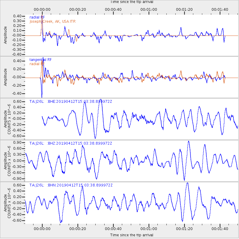
J26L Joseph Creek, AK, USA - Earthquake Result Viewer
*The percent match for this event was below the threshold and hence no stack was calculated.
| Earthquake location: |
New Britain Region, P.N.G. |
| Earthquake latitude/longitude: |
-6.4/148.7 |
| Earthquake time(UTC): |
2019/04/12 (102) 14:51:28 GMT |
| Earthquake Depth: |
10 km |
| Earthquake Magnitude: |
5.9 Mww |
| Earthquake Catalog/Contributor: |
NEIC PDE/us |
|
| Network: |
TA USArray Transportable Network (new EarthScope stations) |
| Station: |
J26L Joseph Creek, AK, USA |
| Lat/Lon: |
64.50 N/143.56 W |
| Elevation: |
1144 m |
|
| Distance: |
86.4 deg |
| Az: |
23.67 deg |
| Baz: |
247.19 deg |
| Ray Param: |
$rayparam |
*The percent match for this event was below the threshold and hence was not used in the summary stack. |
|
| Radial Match: |
59.74987 % |
| Radial Bump: |
400 |
| Transverse Match: |
55.45812 % |
| Transverse Bump: |
400 |
| SOD ConfigId: |
13570011 |
| Insert Time: |
2019-05-02 22:37:58.452 +0000 |
| GWidth: |
2.5 |
| Max Bumps: |
400 |
| Tol: |
0.001 |
|
Signal To Noise
| Channel | StoN | STA | LTA |
| TA:J26L: :BHZ:20190412T15:03:38.899972Z | 0.8648564 | 2.9041863E-7 | 3.3579983E-7 |
| TA:J26L: :BHN:20190412T15:03:38.899972Z | 0.37734088 | 9.972196E-8 | 2.642755E-7 |
| TA:J26L: :BHE:20190412T15:03:38.899972Z | 2.0476477 | 4.843669E-7 | 2.3654798E-7 |
| Arrivals |
| Ps | |
| PpPs | |
| PsPs/PpSs | |


