You are here: Home > Network List > TA - USArray Transportable Network (new EarthScope stations) Stations List
> Station 125A Gardner Draw, Artesia, NM, USA > Earthquake Result Viewer
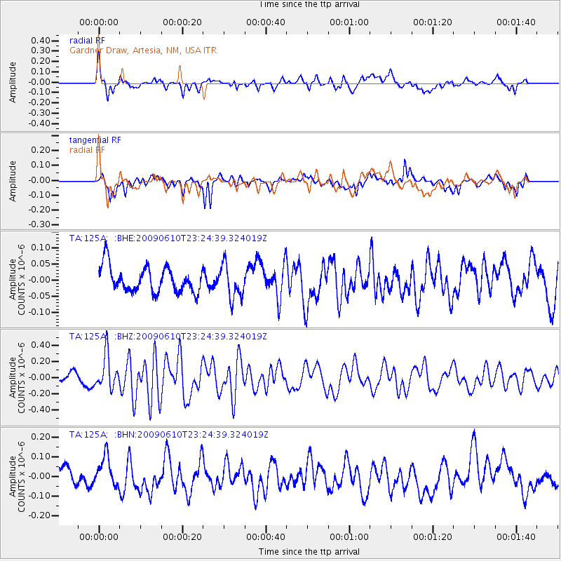
125A Gardner Draw, Artesia, NM, USA - Earthquake Result Viewer
*The percent match for this event was below the threshold and hence no stack was calculated.
| Earthquake location: |
West Chile Rise |
| Earthquake latitude/longitude: |
-41.7/-84.0 |
| Earthquake time(UTC): |
2009/06/10 (161) 23:13:21 GMT |
| Earthquake Depth: |
10 km |
| Earthquake Magnitude: |
5.7 MB, 5.2 MS, 5.7 MW, 5.6 MW |
| Earthquake Catalog/Contributor: |
WHDF/NEIC |
|
| Network: |
TA USArray Transportable Network (new EarthScope stations) |
| Station: |
125A Gardner Draw, Artesia, NM, USA |
| Lat/Lon: |
32.66 N/104.66 W |
| Elevation: |
1212 m |
|
| Distance: |
76.4 deg |
| Az: |
342.169 deg |
| Baz: |
164.23 deg |
| Ray Param: |
$rayparam |
*The percent match for this event was below the threshold and hence was not used in the summary stack. |
|
| Radial Match: |
62.407696 % |
| Radial Bump: |
400 |
| Transverse Match: |
71.94853 % |
| Transverse Bump: |
381 |
| SOD ConfigId: |
2648 |
| Insert Time: |
2010-03-06 21:30:24.224 +0000 |
| GWidth: |
2.5 |
| Max Bumps: |
400 |
| Tol: |
0.001 |
|
Signal To Noise
| Channel | StoN | STA | LTA |
| TA:125A: :BHZ:20090610T23:24:39.324019Z | 2.0897663 | 2.1226356E-7 | 1.0157287E-7 |
| TA:125A: :BHN:20090610T23:24:39.324019Z | 1.2138436 | 7.9348695E-8 | 6.536979E-8 |
| TA:125A: :BHE:20090610T23:24:39.324019Z | 1.3640078 | 5.2867463E-8 | 3.8758916E-8 |
| Arrivals |
| Ps | |
| PpPs | |
| PsPs/PpSs | |


