You are here: Home > Network List > US - United States National Seismic Network Stations List
> Station EGMT Eagleton, Montana, USA > Earthquake Result Viewer
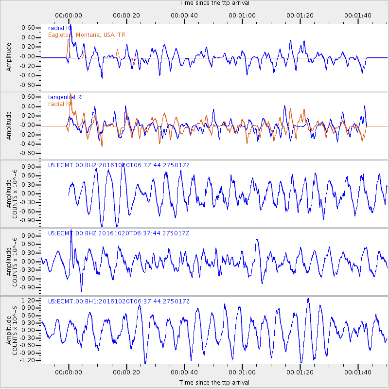
EGMT Eagleton, Montana, USA - Earthquake Result Viewer
*The percent match for this event was below the threshold and hence no stack was calculated.
| Earthquake location: |
Volcano Islands, Japan Region |
| Earthquake latitude/longitude: |
22.3/143.8 |
| Earthquake time(UTC): |
2016/10/20 (294) 06:25:56 GMT |
| Earthquake Depth: |
108 km |
| Earthquake Magnitude: |
5.7 MB |
| Earthquake Catalog/Contributor: |
NEIC PDE/NEIC COMCAT |
|
| Network: |
US United States National Seismic Network |
| Station: |
EGMT Eagleton, Montana, USA |
| Lat/Lon: |
48.02 N/109.75 W |
| Elevation: |
1055 m |
|
| Distance: |
84.1 deg |
| Az: |
40.325 deg |
| Baz: |
296.758 deg |
| Ray Param: |
$rayparam |
*The percent match for this event was below the threshold and hence was not used in the summary stack. |
|
| Radial Match: |
54.080452 % |
| Radial Bump: |
400 |
| Transverse Match: |
51.78762 % |
| Transverse Bump: |
383 |
| SOD ConfigId: |
1815711 |
| Insert Time: |
2016-11-03 06:29:08.972 +0000 |
| GWidth: |
2.5 |
| Max Bumps: |
400 |
| Tol: |
0.001 |
|
Signal To Noise
| Channel | StoN | STA | LTA |
| US:EGMT:00:BHZ:20161020T06:37:44.275017Z | 2.2464983 | 5.141892E-7 | 2.2888474E-7 |
| US:EGMT:00:BH1:20161020T06:37:44.275017Z | 0.6453115 | 3.329159E-7 | 5.1589956E-7 |
| US:EGMT:00:BH2:20161020T06:37:44.275017Z | 0.87370163 | 4.7080565E-7 | 5.388632E-7 |
| Arrivals |
| Ps | |
| PpPs | |
| PsPs/PpSs | |


