You are here: Home > Network List > US - United States National Seismic Network Stations List
> Station WUAZ Wupatki, Arizona, USA > Earthquake Result Viewer
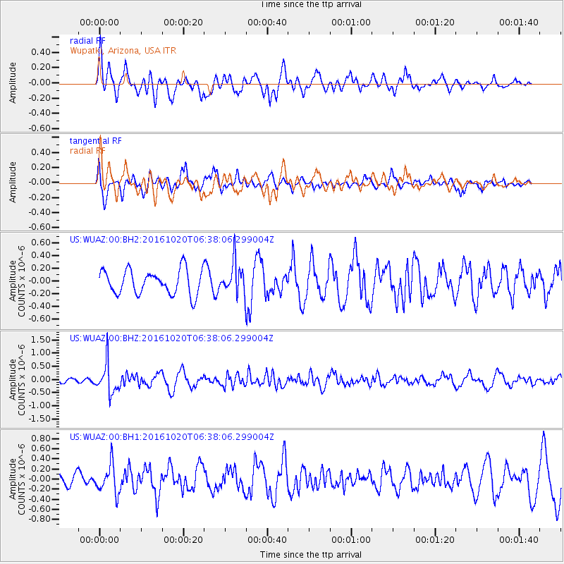
WUAZ Wupatki, Arizona, USA - Earthquake Result Viewer
*The percent match for this event was below the threshold and hence no stack was calculated.
| Earthquake location: |
Volcano Islands, Japan Region |
| Earthquake latitude/longitude: |
22.3/143.8 |
| Earthquake time(UTC): |
2016/10/20 (294) 06:25:56 GMT |
| Earthquake Depth: |
108 km |
| Earthquake Magnitude: |
5.7 MB |
| Earthquake Catalog/Contributor: |
NEIC PDE/NEIC COMCAT |
|
| Network: |
US United States National Seismic Network |
| Station: |
WUAZ Wupatki, Arizona, USA |
| Lat/Lon: |
35.52 N/111.37 W |
| Elevation: |
1592 m |
|
| Distance: |
88.6 deg |
| Az: |
52.064 deg |
| Baz: |
296.426 deg |
| Ray Param: |
$rayparam |
*The percent match for this event was below the threshold and hence was not used in the summary stack. |
|
| Radial Match: |
71.81921 % |
| Radial Bump: |
400 |
| Transverse Match: |
63.829723 % |
| Transverse Bump: |
365 |
| SOD ConfigId: |
1815711 |
| Insert Time: |
2016-11-03 06:29:28.568 +0000 |
| GWidth: |
2.5 |
| Max Bumps: |
400 |
| Tol: |
0.001 |
|
Signal To Noise
| Channel | StoN | STA | LTA |
| US:WUAZ:00:BHZ:20161020T06:38:06.299004Z | 6.913683 | 5.838228E-7 | 8.444454E-8 |
| US:WUAZ:00:BH1:20161020T06:38:06.299004Z | 2.319027 | 2.9100988E-7 | 1.2548793E-7 |
| US:WUAZ:00:BH2:20161020T06:38:06.299004Z | 1.2994491 | 2.506889E-7 | 1.9291937E-7 |
| Arrivals |
| Ps | |
| PpPs | |
| PsPs/PpSs | |


