D22A Cohagen, MT, USA - Earthquake Result Viewer
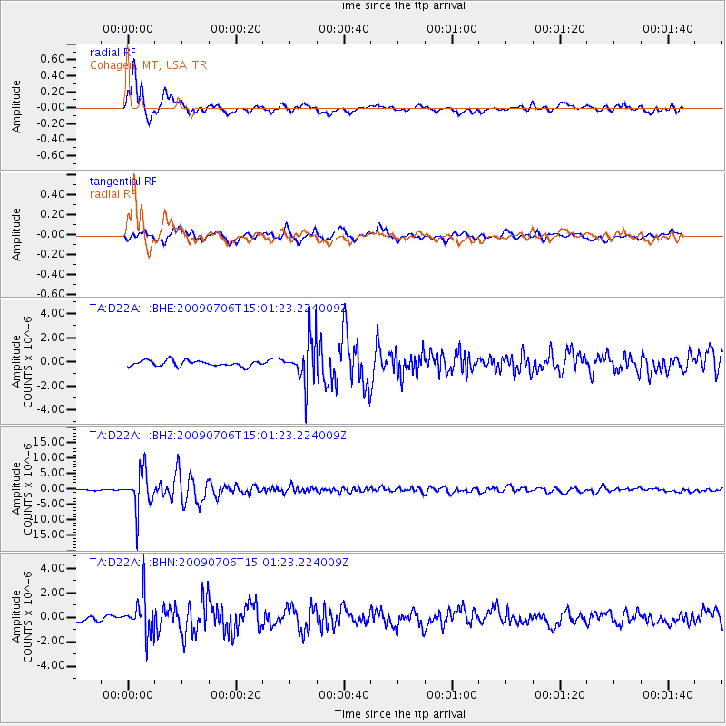
Earthquake location: Rat Islands, Aleutian Islands
Earthquake latitude/longitude: 50.4/177.0
Earthquake time(UTC): 2009/07/06 (187) 14:53:12 GMT
Earthquake Depth: 22 km
Earthquake Magnitude: 6.0 MB, 5.8 MS, 6.1 MW, 6.0 MW
Earthquake Catalog/Contributor: WHDF/NEIC
Network: TA USArray Transportable Network (new EarthScope stations)
Station: D22A Cohagen, MT, USA
Lat/Lon: 47.15 N/106.18 W
Elevation: 791 m
Distance: 48.6 deg
Az: 62.375 deg
Baz: 303.888 deg
Ray Param: 0.069222584
Estimated Moho Depth: 60.5 km
Estimated Crust Vp/Vs: 1.68
Assumed Crust Vp: 6.438 km/s
Estimated Crust Vs: 3.832 km/s
Estimated Crust Poisson's Ratio: 0.23
Radial Match: 90.83954 %
Radial Bump: 400
Transverse Match: 80.02361 %
Transverse Bump: 400
SOD ConfigId: 2648
Insert Time: 2010-03-06 21:31:00.927 +0000
GWidth: 2.5
Max Bumps: 400
Tol: 0.001

Signal To Noise

ChannelStoNSTALTA
TA:D22A: :BHZ:20090706T15:01:23.224009Z47.8785176.1711025E-61.2889085E-7
TA:D22A: :BHN:20090706T15:01:23.224009Z5.14549641.5229272E-62.9597282E-7
TA:D22A: :BHE:20090706T15:01:23.224009Z8.4921241.9678175E-62.3172267E-7
Arrivals
Ps6.8 SECOND
PpPs24 SECOND
PsPs/PpSs30 SECOND