You are here: Home > Network List > UU - University of Utah Regional Network Stations List
> Station KNB Kanab, UT, USA > Earthquake Result Viewer
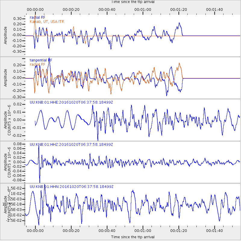
KNB Kanab, UT, USA - Earthquake Result Viewer
*The percent match for this event was below the threshold and hence no stack was calculated.
| Earthquake location: |
Volcano Islands, Japan Region |
| Earthquake latitude/longitude: |
22.3/143.8 |
| Earthquake time(UTC): |
2016/10/20 (294) 06:25:56 GMT |
| Earthquake Depth: |
108 km |
| Earthquake Magnitude: |
5.7 MB |
| Earthquake Catalog/Contributor: |
NEIC PDE/NEIC COMCAT |
|
| Network: |
UU University of Utah Regional Network |
| Station: |
KNB Kanab, UT, USA |
| Lat/Lon: |
37.02 N/112.82 W |
| Elevation: |
1715 m |
|
| Distance: |
86.9 deg |
| Az: |
51.23 deg |
| Baz: |
295.54 deg |
| Ray Param: |
$rayparam |
*The percent match for this event was below the threshold and hence was not used in the summary stack. |
|
| Radial Match: |
43.972477 % |
| Radial Bump: |
400 |
| Transverse Match: |
67.50869 % |
| Transverse Bump: |
400 |
| SOD ConfigId: |
1815711 |
| Insert Time: |
2016-11-03 06:29:45.054 +0000 |
| GWidth: |
2.5 |
| Max Bumps: |
400 |
| Tol: |
0.001 |
|
Signal To Noise
| Channel | StoN | STA | LTA |
| UU:KNB:01:HHZ:20161020T06:37:58.18499Z | 4.093231 | 2.996837E-8 | 7.321446E-9 |
| UU:KNB:01:HHN:20161020T06:37:58.18499Z | 1.1433036 | 9.014164E-9 | 7.884313E-9 |
| UU:KNB:01:HHE:20161020T06:37:58.18499Z | 1.2229838 | 8.437505E-9 | 6.899114E-9 |
| Arrivals |
| Ps | |
| PpPs | |
| PsPs/PpSs | |


