You are here: Home > Network List > TA - USArray Transportable Network (new EarthScope stations) Stations List
> Station D22A Cohagen, MT, USA > Earthquake Result Viewer
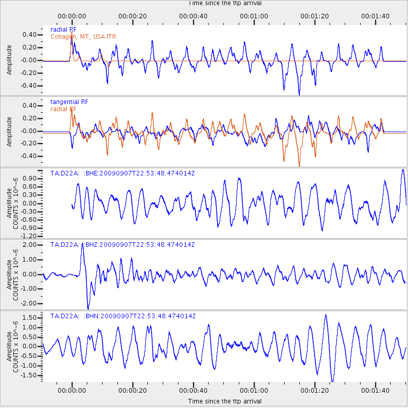
D22A Cohagen, MT, USA - Earthquake Result Viewer
*The percent match for this event was below the threshold and hence no stack was calculated.
| Earthquake location: |
Northwestern Caucasus |
| Earthquake latitude/longitude: |
42.7/43.4 |
| Earthquake time(UTC): |
2009/09/07 (250) 22:41:37 GMT |
| Earthquake Depth: |
15 km |
| Earthquake Magnitude: |
5.7 MB, 5.8 MS, 6.0 MW, 5.9 MW |
| Earthquake Catalog/Contributor: |
WHDF/NEIC |
|
| Network: |
TA USArray Transportable Network (new EarthScope stations) |
| Station: |
D22A Cohagen, MT, USA |
| Lat/Lon: |
47.15 N/106.18 W |
| Elevation: |
791 m |
|
| Distance: |
86.6 deg |
| Az: |
339.772 deg |
| Baz: |
21.943 deg |
| Ray Param: |
$rayparam |
*The percent match for this event was below the threshold and hence was not used in the summary stack. |
|
| Radial Match: |
62.002533 % |
| Radial Bump: |
348 |
| Transverse Match: |
60.56094 % |
| Transverse Bump: |
400 |
| SOD ConfigId: |
2622 |
| Insert Time: |
2010-03-06 21:31:22.340 +0000 |
| GWidth: |
2.5 |
| Max Bumps: |
400 |
| Tol: |
0.001 |
|
Signal To Noise
| Channel | StoN | STA | LTA |
| TA:D22A: :BHZ:20090907T22:53:48.474014Z | 2.8627138 | 8.1317336E-7 | 2.8405682E-7 |
| TA:D22A: :BHN:20090907T22:53:48.474014Z | 0.834395 | 4.5607507E-7 | 5.4659375E-7 |
| TA:D22A: :BHE:20090907T22:53:48.474014Z | 0.63618493 | 2.2833493E-7 | 3.589128E-7 |
| Arrivals |
| Ps | |
| PpPs | |
| PsPs/PpSs | |


