You are here: Home > Network List > TA - USArray Transportable Network (new EarthScope stations) Stations List
> Station D22A Cohagen, MT, USA > Earthquake Result Viewer
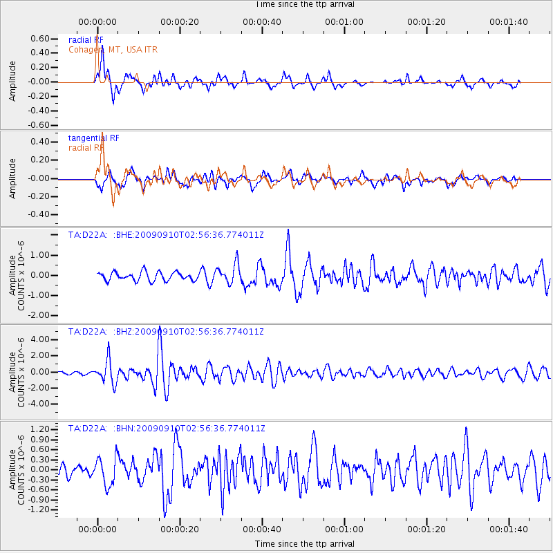
D22A Cohagen, MT, USA - Earthquake Result Viewer
*The percent match for this event was below the threshold and hence no stack was calculated.
| Earthquake location: |
Kuril Islands |
| Earthquake latitude/longitude: |
48.3/154.2 |
| Earthquake time(UTC): |
2009/09/10 (253) 02:46:50 GMT |
| Earthquake Depth: |
36 km |
| Earthquake Magnitude: |
6.0 MB, 5.5 MS, 6.0 MW, 5.8 MW |
| Earthquake Catalog/Contributor: |
WHDF/NEIC |
|
| Network: |
TA USArray Transportable Network (new EarthScope stations) |
| Station: |
D22A Cohagen, MT, USA |
| Lat/Lon: |
47.15 N/106.18 W |
| Elevation: |
791 m |
|
| Distance: |
62.1 deg |
| Az: |
49.593 deg |
| Baz: |
311.868 deg |
| Ray Param: |
$rayparam |
*The percent match for this event was below the threshold and hence was not used in the summary stack. |
|
| Radial Match: |
71.41791 % |
| Radial Bump: |
400 |
| Transverse Match: |
62.50992 % |
| Transverse Bump: |
400 |
| SOD ConfigId: |
2622 |
| Insert Time: |
2010-03-06 21:31:23.923 +0000 |
| GWidth: |
2.5 |
| Max Bumps: |
400 |
| Tol: |
0.001 |
|
Signal To Noise
| Channel | StoN | STA | LTA |
| TA:D22A: :BHZ:20090910T02:56:36.774011Z | 8.666218 | 1.4688447E-6 | 1.6949086E-7 |
| TA:D22A: :BHN:20090910T02:56:36.774011Z | 1.2383233 | 4.2791459E-7 | 3.4555964E-7 |
| TA:D22A: :BHE:20090910T02:56:36.774011Z | 2.3565295 | 4.9627846E-7 | 2.1059718E-7 |
| Arrivals |
| Ps | |
| PpPs | |
| PsPs/PpSs | |


