You are here: Home > Network List > TA - USArray Transportable Network (new EarthScope stations) Stations List
> Station D22A Cohagen, MT, USA > Earthquake Result Viewer
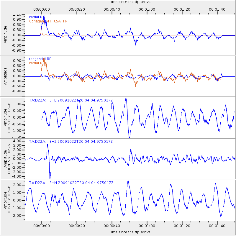
D22A Cohagen, MT, USA - Earthquake Result Viewer
*The percent match for this event was below the threshold and hence no stack was calculated.
| Earthquake location: |
Hindu Kush Region, Afghanistan |
| Earthquake latitude/longitude: |
36.5/70.9 |
| Earthquake time(UTC): |
2009/10/22 (295) 19:51:27 GMT |
| Earthquake Depth: |
186 km |
| Earthquake Magnitude: |
6.1 MB, 6.2 MW, 6.1 MW |
| Earthquake Catalog/Contributor: |
WHDF/NEIC |
|
| Network: |
TA USArray Transportable Network (new EarthScope stations) |
| Station: |
D22A Cohagen, MT, USA |
| Lat/Lon: |
47.15 N/106.18 W |
| Elevation: |
791 m |
|
| Distance: |
96.7 deg |
| Az: |
358.028 deg |
| Baz: |
2.328 deg |
| Ray Param: |
$rayparam |
*The percent match for this event was below the threshold and hence was not used in the summary stack. |
|
| Radial Match: |
60.11151 % |
| Radial Bump: |
400 |
| Transverse Match: |
57.08215 % |
| Transverse Bump: |
400 |
| SOD ConfigId: |
2622 |
| Insert Time: |
2010-03-06 21:31:38.910 +0000 |
| GWidth: |
2.5 |
| Max Bumps: |
400 |
| Tol: |
0.001 |
|
Signal To Noise
| Channel | StoN | STA | LTA |
| TA:D22A: :BHZ:20091022T20:04:04.975017Z | 6.6356516 | 1.5858227E-6 | 2.3898522E-7 |
| TA:D22A: :BHN:20091022T20:04:04.975017Z | 0.6418447 | 8.482751E-7 | 1.3216204E-6 |
| TA:D22A: :BHE:20091022T20:04:04.975017Z | 0.9257112 | 5.6069206E-7 | 6.0568783E-7 |
| Arrivals |
| Ps | |
| PpPs | |
| PsPs/PpSs | |


