You are here: Home > Network List > TA - USArray Transportable Network (new EarthScope stations) Stations List
> Station D22A Cohagen, MT, USA > Earthquake Result Viewer
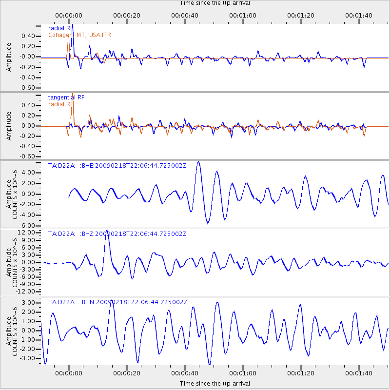
D22A Cohagen, MT, USA - Earthquake Result Viewer
*The percent match for this event was below the threshold and hence no stack was calculated.
| Earthquake location: |
Kermadec Islands Region |
| Earthquake latitude/longitude: |
-27.4/-176.3 |
| Earthquake time(UTC): |
2009/02/18 (049) 21:53:45 GMT |
| Earthquake Depth: |
25 km |
| Earthquake Magnitude: |
6.8 MB, 7.2 MS, 6.9 MW, 6.9 MW |
| Earthquake Catalog/Contributor: |
WHDF/NEIC |
|
| Network: |
TA USArray Transportable Network (new EarthScope stations) |
| Station: |
D22A Cohagen, MT, USA |
| Lat/Lon: |
47.15 N/106.18 W |
| Elevation: |
791 m |
|
| Distance: |
97.4 deg |
| Az: |
40.344 deg |
| Baz: |
237.468 deg |
| Ray Param: |
$rayparam |
*The percent match for this event was below the threshold and hence was not used in the summary stack. |
|
| Radial Match: |
82.55137 % |
| Radial Bump: |
308 |
| Transverse Match: |
64.91043 % |
| Transverse Bump: |
275 |
| SOD ConfigId: |
2658 |
| Insert Time: |
2010-03-06 21:31:44.732 +0000 |
| GWidth: |
2.5 |
| Max Bumps: |
400 |
| Tol: |
0.001 |
|
Signal To Noise
| Channel | StoN | STA | LTA |
| TA:D22A: :BHZ:20090218T22:06:44.725002Z | 2.827824 | 1.1560419E-6 | 4.0880965E-7 |
| TA:D22A: :BHN:20090218T22:06:44.725002Z | 0.17997362 | 2.9028726E-7 | 1.6129435E-6 |
| TA:D22A: :BHE:20090218T22:06:44.725002Z | 1.561869 | 1.1395814E-6 | 7.296268E-7 |
| Arrivals |
| Ps | |
| PpPs | |
| PsPs/PpSs | |


