You are here: Home > Network List > TA - USArray Transportable Network (new EarthScope stations) Stations List
> Station D22A Cohagen, MT, USA > Earthquake Result Viewer
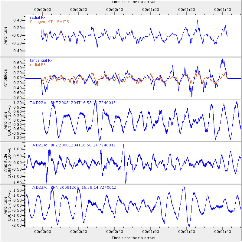
D22A Cohagen, MT, USA - Earthquake Result Viewer
*The percent match for this event was below the threshold and hence no stack was calculated.
| Earthquake location: |
Chile-Bolivia Border Region |
| Earthquake latitude/longitude: |
-21.4/-68.3 |
| Earthquake time(UTC): |
2008/12/04 (339) 16:47:09 GMT |
| Earthquake Depth: |
115 km |
| Earthquake Magnitude: |
5.5 MB, 5.5 MW, 5.5 MW |
| Earthquake Catalog/Contributor: |
WHDF/NEIC |
|
| Network: |
TA USArray Transportable Network (new EarthScope stations) |
| Station: |
D22A Cohagen, MT, USA |
| Lat/Lon: |
47.15 N/106.18 W |
| Elevation: |
791 m |
|
| Distance: |
76.3 deg |
| Az: |
334.438 deg |
| Baz: |
143.902 deg |
| Ray Param: |
$rayparam |
*The percent match for this event was below the threshold and hence was not used in the summary stack. |
|
| Radial Match: |
39.87409 % |
| Radial Bump: |
400 |
| Transverse Match: |
57.71685 % |
| Transverse Bump: |
400 |
| SOD ConfigId: |
2658 |
| Insert Time: |
2010-03-06 21:31:51.314 +0000 |
| GWidth: |
2.5 |
| Max Bumps: |
400 |
| Tol: |
0.001 |
|
Signal To Noise
| Channel | StoN | STA | LTA |
| TA:D22A: :BHZ:20081204T16:58:14.724001Z | 1.9621637 | 5.641782E-7 | 2.8752862E-7 |
| TA:D22A: :BHN:20081204T16:58:14.724001Z | 1.4988389 | 9.4657645E-7 | 6.315398E-7 |
| TA:D22A: :BHE:20081204T16:58:14.724001Z | 1.5294794 | 8.940721E-7 | 5.845598E-7 |
| Arrivals |
| Ps | |
| PpPs | |
| PsPs/PpSs | |


