You are here: Home > Network List > WY - Yellowstone Wyoming Seismic Network Stations List
> Station YHH Holmes Hill, YNP, WY, USA > Earthquake Result Viewer
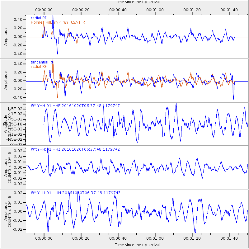
YHH Holmes Hill, YNP, WY, USA - Earthquake Result Viewer
*The percent match for this event was below the threshold and hence no stack was calculated.
| Earthquake location: |
Volcano Islands, Japan Region |
| Earthquake latitude/longitude: |
22.3/143.8 |
| Earthquake time(UTC): |
2016/10/20 (294) 06:25:56 GMT |
| Earthquake Depth: |
108 km |
| Earthquake Magnitude: |
5.7 MB |
| Earthquake Catalog/Contributor: |
NEIC PDE/NEIC COMCAT |
|
| Network: |
WY Yellowstone Wyoming Seismic Network |
| Station: |
YHH Holmes Hill, YNP, WY, USA |
| Lat/Lon: |
44.79 N/110.85 W |
| Elevation: |
2717 m |
|
| Distance: |
84.9 deg |
| Az: |
43.575 deg |
| Baz: |
296.28 deg |
| Ray Param: |
$rayparam |
*The percent match for this event was below the threshold and hence was not used in the summary stack. |
|
| Radial Match: |
54.06039 % |
| Radial Bump: |
400 |
| Transverse Match: |
59.71248 % |
| Transverse Bump: |
400 |
| SOD ConfigId: |
1815711 |
| Insert Time: |
2016-11-03 06:30:27.728 +0000 |
| GWidth: |
2.5 |
| Max Bumps: |
400 |
| Tol: |
0.001 |
|
Signal To Noise
| Channel | StoN | STA | LTA |
| WY:YHH:01:HHZ:20161020T06:37:48.117974Z | 3.757181 | 1.3255132E-8 | 3.5279462E-9 |
| WY:YHH:01:HHN:20161020T06:37:48.117974Z | 1.5323871 | 9.341533E-9 | 6.096066E-9 |
| WY:YHH:01:HHE:20161020T06:37:48.117974Z | 0.77894914 | 6.2873533E-9 | 8.071584E-9 |
| Arrivals |
| Ps | |
| PpPs | |
| PsPs/PpSs | |


