You are here: Home > Network List > WY - Yellowstone Wyoming Seismic Network Stations List
> Station YHR Hawk's Rest, WY, USA > Earthquake Result Viewer
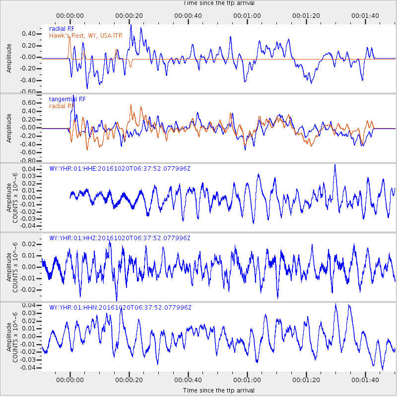
YHR Hawk's Rest, WY, USA - Earthquake Result Viewer
*The percent match for this event was below the threshold and hence no stack was calculated.
| Earthquake location: |
Volcano Islands, Japan Region |
| Earthquake latitude/longitude: |
22.3/143.8 |
| Earthquake time(UTC): |
2016/10/20 (294) 06:25:56 GMT |
| Earthquake Depth: |
108 km |
| Earthquake Magnitude: |
5.7 MB |
| Earthquake Catalog/Contributor: |
NEIC PDE/NEIC COMCAT |
|
| Network: |
WY Yellowstone Wyoming Seismic Network |
| Station: |
YHR Hawk's Rest, WY, USA |
| Lat/Lon: |
44.11 N/110.08 W |
| Elevation: |
2976 m |
|
| Distance: |
85.7 deg |
| Az: |
43.94 deg |
| Baz: |
296.846 deg |
| Ray Param: |
$rayparam |
*The percent match for this event was below the threshold and hence was not used in the summary stack. |
|
| Radial Match: |
35.70186 % |
| Radial Bump: |
400 |
| Transverse Match: |
36.88993 % |
| Transverse Bump: |
400 |
| SOD ConfigId: |
1815711 |
| Insert Time: |
2016-11-03 06:30:33.536 +0000 |
| GWidth: |
2.5 |
| Max Bumps: |
400 |
| Tol: |
0.001 |
|
Signal To Noise
| Channel | StoN | STA | LTA |
| WY:YHR:01:HHZ:20161020T06:37:52.077996Z | 2.3892417 | 1.1236388E-8 | 4.7029096E-9 |
| WY:YHR:01:HHN:20161020T06:37:52.077996Z | 1.0242594 | 1.7914928E-8 | 1.7490617E-8 |
| WY:YHR:01:HHE:20161020T06:37:52.077996Z | 1.5026963 | 1.0165963E-8 | 6.7651484E-9 |
| Arrivals |
| Ps | |
| PpPs | |
| PsPs/PpSs | |


