You are here: Home > Network List > TA - USArray Transportable Network (new EarthScope stations) Stations List
> Station D22A Cohagen, MT, USA > Earthquake Result Viewer
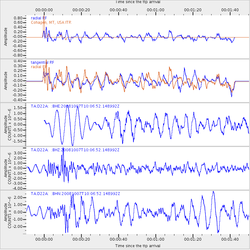
D22A Cohagen, MT, USA - Earthquake Result Viewer
*The percent match for this event was below the threshold and hence no stack was calculated.
| Earthquake location: |
Arctic Ocean |
| Earthquake latitude/longitude: |
79.8/-115.4 |
| Earthquake time(UTC): |
2008/10/07 (281) 10:00:48 GMT |
| Earthquake Depth: |
10 km |
| Earthquake Magnitude: |
5.6 MB, 5.5 MS, 5.7 MW, 5.7 MW |
| Earthquake Catalog/Contributor: |
WHDF/NEIC |
|
| Network: |
TA USArray Transportable Network (new EarthScope stations) |
| Station: |
D22A Cohagen, MT, USA |
| Lat/Lon: |
47.15 N/106.18 W |
| Elevation: |
791 m |
|
| Distance: |
33.0 deg |
| Az: |
168.343 deg |
| Baz: |
356.98 deg |
| Ray Param: |
$rayparam |
*The percent match for this event was below the threshold and hence was not used in the summary stack. |
|
| Radial Match: |
51.41263 % |
| Radial Bump: |
384 |
| Transverse Match: |
54.067924 % |
| Transverse Bump: |
400 |
| SOD ConfigId: |
2556 |
| Insert Time: |
2010-03-06 21:32:21.009 +0000 |
| GWidth: |
2.5 |
| Max Bumps: |
400 |
| Tol: |
0.001 |
|
Signal To Noise
| Channel | StoN | STA | LTA |
| TA:D22A: :BHZ:20081007T10:06:52.148992Z | 3.0667367 | 7.671012E-7 | 2.5013597E-7 |
| TA:D22A: :BHN:20081007T10:06:52.148992Z | 0.8655005 | 5.4936874E-7 | 6.3474107E-7 |
| TA:D22A: :BHE:20081007T10:06:52.148992Z | 0.33257177 | 3.2470612E-7 | 9.76349E-7 |
| Arrivals |
| Ps | |
| PpPs | |
| PsPs/PpSs | |


