You are here: Home > Network List > TA - USArray Transportable Network (new EarthScope stations) Stations List
> Station D22A Cohagen, MT, USA > Earthquake Result Viewer
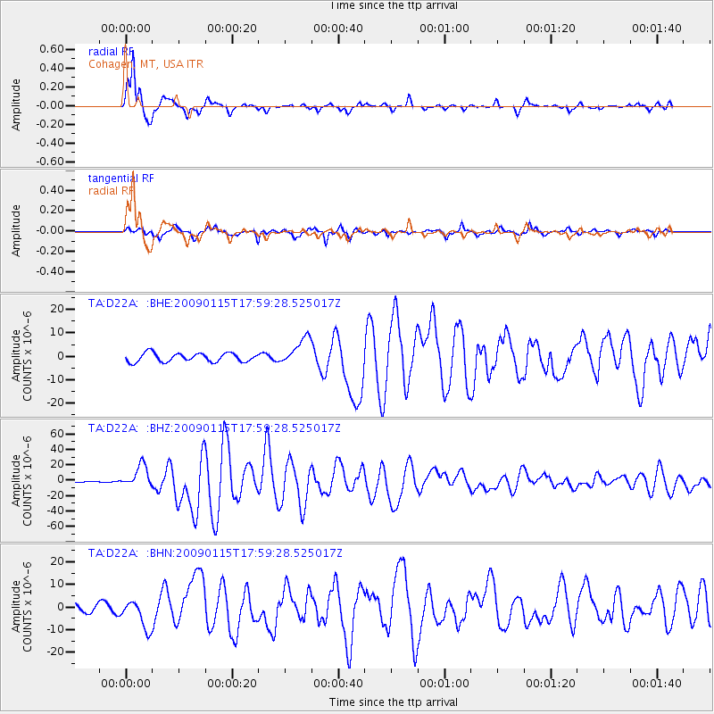
D22A Cohagen, MT, USA - Earthquake Result Viewer
*The percent match for this event was below the threshold and hence no stack was calculated.
| Earthquake location: |
East Of Kuril Islands |
| Earthquake latitude/longitude: |
46.9/155.2 |
| Earthquake time(UTC): |
2009/01/15 (015) 17:49:39 GMT |
| Earthquake Depth: |
36 km |
| Earthquake Magnitude: |
6.9 MB, 7.5 MS, 7.4 MW, 7.4 MW |
| Earthquake Catalog/Contributor: |
WHDF/NEIC |
|
| Network: |
TA USArray Transportable Network (new EarthScope stations) |
| Station: |
D22A Cohagen, MT, USA |
| Lat/Lon: |
47.15 N/106.18 W |
| Elevation: |
791 m |
|
| Distance: |
62.5 deg |
| Az: |
49.496 deg |
| Baz: |
310.136 deg |
| Ray Param: |
$rayparam |
*The percent match for this event was below the threshold and hence was not used in the summary stack. |
|
| Radial Match: |
96.5729 % |
| Radial Bump: |
324 |
| Transverse Match: |
86.608284 % |
| Transverse Bump: |
400 |
| SOD ConfigId: |
2834 |
| Insert Time: |
2010-03-06 21:32:38.941 +0000 |
| GWidth: |
2.5 |
| Max Bumps: |
400 |
| Tol: |
0.001 |
|
Signal To Noise
| Channel | StoN | STA | LTA |
| TA:D22A: :BHZ:20090115T17:59:28.525017Z | 25.781082 | 1.4593172E-5 | 5.660419E-7 |
| TA:D22A: :BHN:20090115T17:59:28.525017Z | 4.6912947 | 6.504034E-6 | 1.3864048E-6 |
| TA:D22A: :BHE:20090115T17:59:28.525017Z | 3.1932714 | 5.8968344E-6 | 1.8466436E-6 |
| Arrivals |
| Ps | |
| PpPs | |
| PsPs/PpSs | |


