You are here: Home > Network List > GS - US Geological Survey Networks Stations List
> Station DEC08 Decatur Surface Seismic Site, Decatur, IL, USA > Earthquake Result Viewer
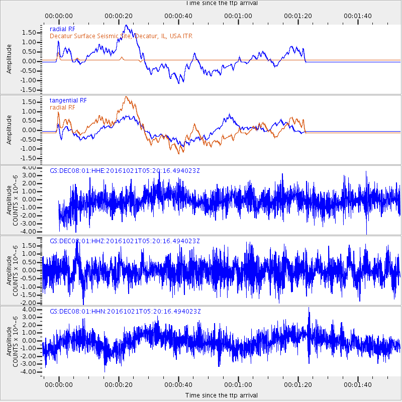
DEC08 Decatur Surface Seismic Site, Decatur, IL, USA - Earthquake Result Viewer
*The percent match for this event was below the threshold and hence no stack was calculated.
| Earthquake location: |
Western Honshu, Japan |
| Earthquake latitude/longitude: |
35.4/133.8 |
| Earthquake time(UTC): |
2016/10/21 (295) 05:07:23 GMT |
| Earthquake Depth: |
10 km |
| Earthquake Magnitude: |
6.2 MWW, 6.6 MI |
| Earthquake Catalog/Contributor: |
NEIC PDE/NEIC COMCAT |
|
| Network: |
GS US Geological Survey Networks |
| Station: |
DEC08 Decatur Surface Seismic Site, Decatur, IL, USA |
| Lat/Lon: |
39.86 N/88.92 W |
| Elevation: |
210 m |
|
| Distance: |
95.4 deg |
| Az: |
31.641 deg |
| Baz: |
326.146 deg |
| Ray Param: |
$rayparam |
*The percent match for this event was below the threshold and hence was not used in the summary stack. |
|
| Radial Match: |
30.589933 % |
| Radial Bump: |
400 |
| Transverse Match: |
44.306026 % |
| Transverse Bump: |
400 |
| SOD ConfigId: |
1815711 |
| Insert Time: |
2016-11-04 05:08:58.368 +0000 |
| GWidth: |
2.5 |
| Max Bumps: |
400 |
| Tol: |
0.001 |
|
Signal To Noise
| Channel | StoN | STA | LTA |
| GS:DEC08:01:HHZ:20161021T05:20:16.494023Z | 0.93463016 | 5.9701824E-7 | 6.3877485E-7 |
| GS:DEC08:01:HHN:20161021T05:20:16.494023Z | 0.57350004 | 1.2992873E-6 | 2.26554E-6 |
| GS:DEC08:01:HHE:20161021T05:20:16.494023Z | 1.3477094 | 1.5947961E-6 | 1.1833382E-6 |
| Arrivals |
| Ps | |
| PpPs | |
| PsPs/PpSs | |


