
D14A Greenough, MT, USA - Earthquake Result Viewer
| ||||||||||||||||||
| ||||||||||||||||||
| ||||||||||||||||||
|
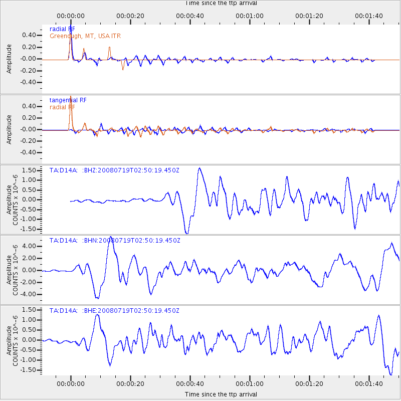
Signal To Noise
| Channel | StoN | STA | LTA |
| TA:D14A: :BHN:20080719T02:50:19.450Z | 5.4916434 | 4.852308E-7 | 8.8358036E-8 |
| TA:D14A: :BHE:20080719T02:50:19.450Z | 2.0739372 | 1.0878765E-7 | 5.245465E-8 |
| TA:D14A: :BHZ:20080719T02:50:19.450Z | 3.6397412 | 2.0084386E-7 | 5.518081E-8 |
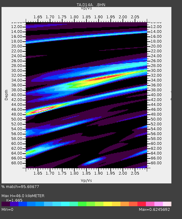
| Arrivals | |
| Ps | 5.0 SECOND |
| PpPs | 19 SECOND |
| PsPs/PpSs | 24 SECOND |

