You are here: Home > Network List > II - Global Seismograph Network (GSN - IRIS/IDA) Stations List
> Station WRAB Tennant Creek, NT, Australia > Earthquake Result Viewer
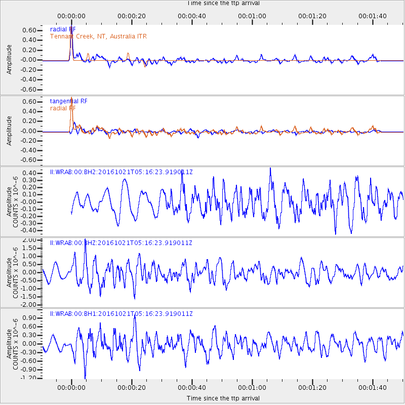
WRAB Tennant Creek, NT, Australia - Earthquake Result Viewer
*The percent match for this event was below the threshold and hence no stack was calculated.
| Earthquake location: |
Western Honshu, Japan |
| Earthquake latitude/longitude: |
35.4/133.8 |
| Earthquake time(UTC): |
2016/10/21 (295) 05:07:23 GMT |
| Earthquake Depth: |
10 km |
| Earthquake Magnitude: |
6.2 MWW, 6.6 MI |
| Earthquake Catalog/Contributor: |
NEIC PDE/NEIC COMCAT |
|
| Network: |
II Global Seismograph Network (GSN - IRIS/IDA) |
| Station: |
WRAB Tennant Creek, NT, Australia |
| Lat/Lon: |
19.93 S/134.36 E |
| Elevation: |
366 m |
|
| Distance: |
55.0 deg |
| Az: |
179.358 deg |
| Baz: |
359.442 deg |
| Ray Param: |
$rayparam |
*The percent match for this event was below the threshold and hence was not used in the summary stack. |
|
| Radial Match: |
75.92023 % |
| Radial Bump: |
400 |
| Transverse Match: |
63.180244 % |
| Transverse Bump: |
400 |
| SOD ConfigId: |
1815711 |
| Insert Time: |
2016-11-04 05:10:12.108 +0000 |
| GWidth: |
2.5 |
| Max Bumps: |
400 |
| Tol: |
0.001 |
|
Signal To Noise
| Channel | StoN | STA | LTA |
| II:WRAB:00:BHZ:20161021T05:16:23.919011Z | 3.093592 | 7.9349786E-7 | 2.5649726E-7 |
| II:WRAB:00:BH1:20161021T05:16:23.919011Z | 2.0490851 | 4.576188E-7 | 2.2332834E-7 |
| II:WRAB:00:BH2:20161021T05:16:23.919011Z | 0.7503295 | 1.1259346E-7 | 1.5005868E-7 |
| Arrivals |
| Ps | |
| PpPs | |
| PsPs/PpSs | |


