D14A Greenough, MT, USA - Earthquake Result Viewer
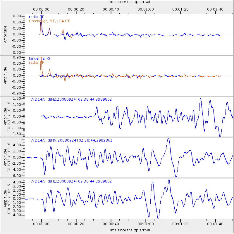
Earthquake location: Off Coast Of Jalisco, Mexico
Earthquake latitude/longitude: 17.6/-105.5
Earthquake time(UTC): 2008/09/24 (268) 02:33:05 GMT
Earthquake Depth: 10 km
Earthquake Magnitude: 5.7 MB, 6.2 MS, 6.4 MW, 6.4 MW
Earthquake Catalog/Contributor: WHDF/NEIC
Network: TA USArray Transportable Network (new EarthScope stations)
Station: D14A Greenough, MT, USA
Lat/Lon: 47.08 N/113.51 W
Elevation: 1444 m
Distance: 30.1 deg
Az: 349.068 deg
Baz: 164.653 deg
Ray Param: 0.07941387
Estimated Moho Depth: 25.75 km
Estimated Crust Vp/Vs: 2.10
Assumed Crust Vp: 6.353 km/s
Estimated Crust Vs: 3.029 km/s
Estimated Crust Poisson's Ratio: 0.35
Radial Match: 94.10327 %
Radial Bump: 270
Transverse Match: 79.15336 %
Transverse Bump: 400
SOD ConfigId: 2560
Insert Time: 2010-03-06 21:33:12.134 +0000
GWidth: 2.5
Max Bumps: 400
Tol: 0.001

Signal To Noise

ChannelStoNSTALTA
TA:D14A: :BHN:20080924T02:38:44.398986Z32.579582.242079E-66.8818544E-8
TA:D14A: :BHE:20080924T02:38:44.398986Z18.9015181.3623642E-67.207698E-8
TA:D14A: :BHZ:20080924T02:38:44.398986Z5.7457093.3607807E-75.8492013E-8
Arrivals
Ps4.8 SECOND
PpPs12 SECOND
PsPs/PpSs17 SECOND