D14A Greenough, MT, USA - Earthquake Result Viewer
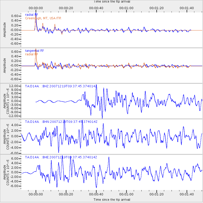
Earthquake location: Andreanof Islands, Aleutian Is.
Earthquake latitude/longitude: 51.4/-179.5
Earthquake time(UTC): 2007/12/19 (353) 09:30:27 GMT
Earthquake Depth: 29 km
Earthquake Magnitude: 6.4 MB, 7.1 MS, 7.1 MW, 7.0 MW
Earthquake Catalog/Contributor: WHDF/NEIC
Network: TA USArray Transportable Network (new EarthScope stations)
Station: D14A Greenough, MT, USA
Lat/Lon: 47.08 N/113.51 W
Elevation: 1444 m
Distance: 42.0 deg
Az: 68.873 deg
Baz: 301.161 deg
Ray Param: 0.07336453
Estimated Moho Depth: 29.5 km
Estimated Crust Vp/Vs: 1.93
Assumed Crust Vp: 6.353 km/s
Estimated Crust Vs: 3.296 km/s
Estimated Crust Poisson's Ratio: 0.32
Radial Match: 89.8336 %
Radial Bump: 364
Transverse Match: 75.13469 %
Transverse Bump: 400
SOD ConfigId: 2564
Insert Time: 2010-03-06 21:33:51.331 +0000
GWidth: 2.5
Max Bumps: 400
Tol: 0.001

Signal To Noise

ChannelStoNSTALTA
TA:D14A: :BHN:20071219T09:37:45.374014Z1.30811241.0954953E-68.374627E-7
TA:D14A: :BHE:20071219T09:37:45.374014Z2.27625781.8471586E-68.114892E-7
TA:D14A: :BHZ:20071219T09:37:45.374014Z6.5825463.488183E-65.299139E-7
Arrivals
Ps4.6 SECOND
PpPs13 SECOND
PsPs/PpSs17 SECOND