You are here: Home > Network List > IW - Intermountain West Stations List
> Station MOOW Moose Ponds, Wyoming, USA > Earthquake Result Viewer
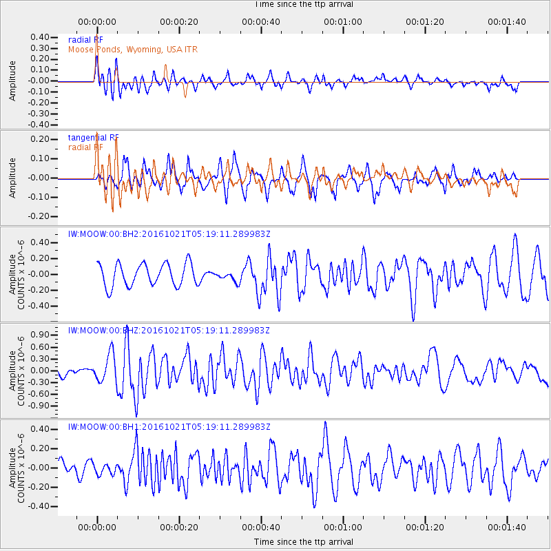
MOOW Moose Ponds, Wyoming, USA - Earthquake Result Viewer
*The percent match for this event was below the threshold and hence no stack was calculated.
| Earthquake location: |
Western Honshu, Japan |
| Earthquake latitude/longitude: |
35.4/133.8 |
| Earthquake time(UTC): |
2016/10/21 (295) 05:07:23 GMT |
| Earthquake Depth: |
10 km |
| Earthquake Magnitude: |
6.2 MWW, 6.6 MI |
| Earthquake Catalog/Contributor: |
NEIC PDE/NEIC COMCAT |
|
| Network: |
IW Intermountain West |
| Station: |
MOOW Moose Ponds, Wyoming, USA |
| Lat/Lon: |
43.75 N/110.74 W |
| Elevation: |
2128 m |
|
| Distance: |
81.8 deg |
| Az: |
41.383 deg |
| Baz: |
311.786 deg |
| Ray Param: |
$rayparam |
*The percent match for this event was below the threshold and hence was not used in the summary stack. |
|
| Radial Match: |
71.94442 % |
| Radial Bump: |
400 |
| Transverse Match: |
58.674843 % |
| Transverse Bump: |
381 |
| SOD ConfigId: |
1815711 |
| Insert Time: |
2016-11-04 05:11:14.568 +0000 |
| GWidth: |
2.5 |
| Max Bumps: |
400 |
| Tol: |
0.001 |
|
Signal To Noise
| Channel | StoN | STA | LTA |
| IW:MOOW:00:BHZ:20161021T05:19:11.289983Z | 2.2958138 | 3.661829E-7 | 1.5950025E-7 |
| IW:MOOW:00:BH1:20161021T05:19:11.289983Z | 0.5005293 | 5.3298216E-8 | 1.0648371E-7 |
| IW:MOOW:00:BH2:20161021T05:19:11.289983Z | 0.47434482 | 6.6721256E-8 | 1.4065982E-7 |
| Arrivals |
| Ps | |
| PpPs | |
| PsPs/PpSs | |


