You are here: Home > Network List > TS - TERRAscope (Southern California Seismic Network) Stations List
> Station DGR Domenigoni Valley Reservior, California, USA > Earthquake Result Viewer
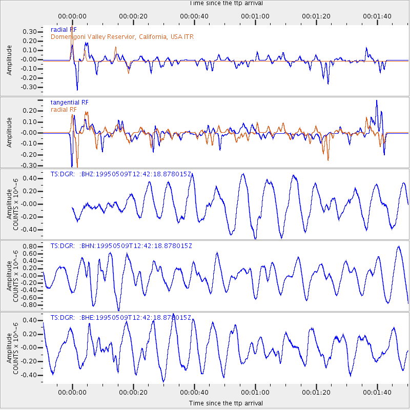
DGR Domenigoni Valley Reservior, California, USA - Earthquake Result Viewer
*The percent match for this event was below the threshold and hence no stack was calculated.
| Earthquake location: |
Pacific-Antarctic Ridge |
| Earthquake latitude/longitude: |
-54.0/-134.3 |
| Earthquake time(UTC): |
1995/05/09 (129) 12:29:57 GMT |
| Earthquake Depth: |
10 km |
| Earthquake Magnitude: |
5.4 MB, 5.7 MS, 5.9 UNKNOWN |
| Earthquake Catalog/Contributor: |
WHDF/NEIC |
|
| Network: |
TS TERRAscope (Southern California Seismic Network) |
| Station: |
DGR Domenigoni Valley Reservior, California, USA |
| Lat/Lon: |
33.65 N/117.01 W |
| Elevation: |
700 m |
|
| Distance: |
88.5 deg |
| Az: |
14.371 deg |
| Baz: |
190.122 deg |
| Ray Param: |
$rayparam |
*The percent match for this event was below the threshold and hence was not used in the summary stack. |
|
| Radial Match: |
53.803757 % |
| Radial Bump: |
336 |
| Transverse Match: |
59.932335 % |
| Transverse Bump: |
400 |
| SOD ConfigId: |
4480 |
| Insert Time: |
2010-02-26 14:10:44.863 +0000 |
| GWidth: |
2.5 |
| Max Bumps: |
400 |
| Tol: |
0.001 |
|
Signal To Noise
| Channel | StoN | STA | LTA |
| TS:DGR: :BHN:19950509T12:42:18.878015Z | 2.3504136 | 3.3476687E-7 | 1.4242893E-7 |
| TS:DGR: :BHE:19950509T12:42:18.878015Z | 0.5299134 | 2.0477691E-7 | 3.8643466E-7 |
| TS:DGR: :BHZ:19950509T12:42:18.878015Z | 2.1539428 | 2.2657669E-7 | 1.051916E-7 |
| Arrivals |
| Ps | |
| PpPs | |
| PsPs/PpSs | |


