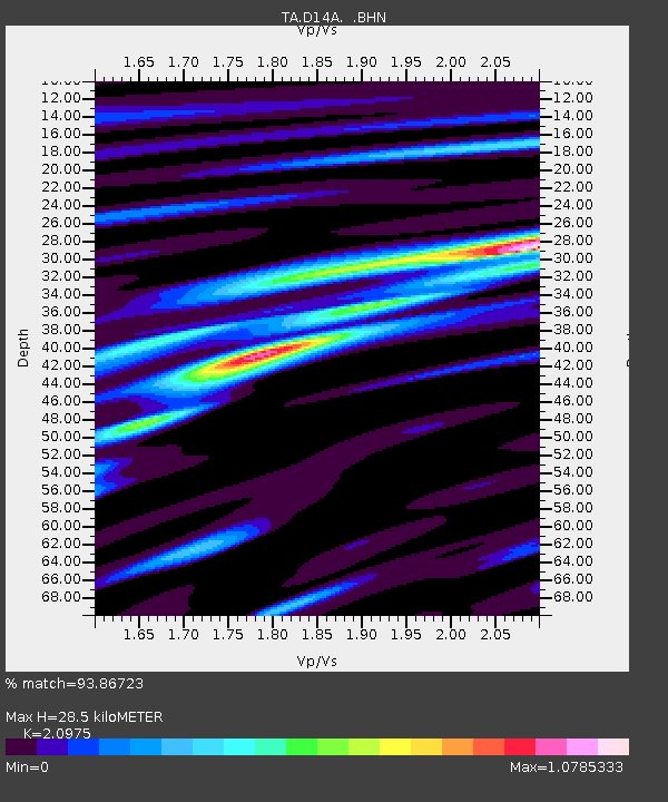
D14A Greenough, MT, USA - Earthquake Result Viewer
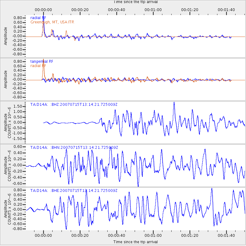
Earthquake location: Fox Islands, Aleutian Islands
Earthquake latitude/longitude: 52.5/-168.0
Earthquake time(UTC): 2007/07/15 (196) 13:08:00 GMT
Earthquake Depth: 10 km
Earthquake Magnitude: 5.8 MB, 5.9 MS, 6.1 MW, 6.0 MW
Earthquake Catalog/Contributor: WHDF/NEIC
Network: TA USArray Transportable Network (new EarthScope stations)
Station: D14A Greenough, MT, USA
Lat/Lon: 47.08 N/113.51 W
Elevation: 1444 m
Distance: 34.9 deg
Az: 76.577 deg
Baz: 299.481 deg
Ray Param: 0.0774977
Estimated Moho Depth: 28.5 km
Estimated Crust Vp/Vs: 2.10
Assumed Crust Vp: 6.353 km/s
Estimated Crust Vs: 3.029 km/s
Estimated Crust Poisson's Ratio: 0.35
Radial Match: 93.86723 %
Radial Bump: 319
Transverse Match: 76.206245 %
Transverse Bump: 400
SOD ConfigId: 2564
Insert Time: 2010-03-06 21:34:25.302 +0000
GWidth: 2.5
Max Bumps: 400
Tol: 0.001

Signal To Noise

ChannelStoNSTALTA
TA:D14A: :BHN:20070715T13:14:21.725009Z3.72386931.14737475E-73.081136E-8
TA:D14A: :BHE:20070715T13:14:21.725009Z6.2511742.0240263E-73.237834E-8
TA:D14A: :BHZ:20070715T13:14:21.725009Z8.5961223.7592383E-74.373179E-8
Arrivals
Ps5.2 SECOND
PpPs13 SECOND
PsPs/PpSs18 SECOND