D14A Greenough, MT, USA - Earthquake Result Viewer
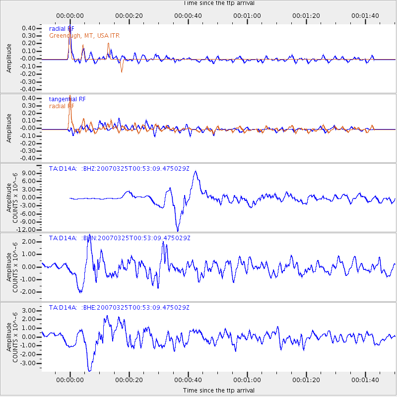
Earthquake location: Near West Coast Of Honshu, Japan
Earthquake latitude/longitude: 37.3/136.6
Earthquake time(UTC): 2007/03/25 (084) 00:41:57 GMT
Earthquake Depth: 8.0 km
Earthquake Magnitude: 6.1 MB, 6.8 MS, 6.7 MW, 6.6 MW
Earthquake Catalog/Contributor: WHDF/NEIC
Network: TA USArray Transportable Network (new EarthScope stations)
Station: D14A Greenough, MT, USA
Lat/Lon: 47.08 N/113.51 W
Elevation: 1444 m
Distance: 75.2 deg
Az: 41.653 deg
Baz: 309.182 deg
Ray Param: 0.051830288
Estimated Moho Depth: 46.25 km
Estimated Crust Vp/Vs: 1.64
Assumed Crust Vp: 6.353 km/s
Estimated Crust Vs: 3.862 km/s
Estimated Crust Poisson's Ratio: 0.21
Radial Match: 92.30647 %
Radial Bump: 400
Transverse Match: 76.80656 %
Transverse Bump: 400
SOD ConfigId: 2564
Insert Time: 2010-03-06 21:34:42.176 +0000
GWidth: 2.5
Max Bumps: 400
Tol: 0.001

Signal To Noise

ChannelStoNSTALTA
TA:D14A: :BHN:20070325T00:53:09.475029Z7.5755811.1721627E-61.5472908E-7
TA:D14A: :BHE:20070325T00:53:09.475029Z2.96393518.4978313E-72.8670775E-7
TA:D14A: :BHZ:20070325T00:53:09.475029Z3.77026322.7561337E-67.3101893E-7
Arrivals
Ps4.9 SECOND
PpPs19 SECOND
PsPs/PpSs23 SECOND