You are here: Home > Network List > TA - USArray Transportable Network (new EarthScope stations) Stations List
> Station D14A Greenough, MT, USA > Earthquake Result Viewer
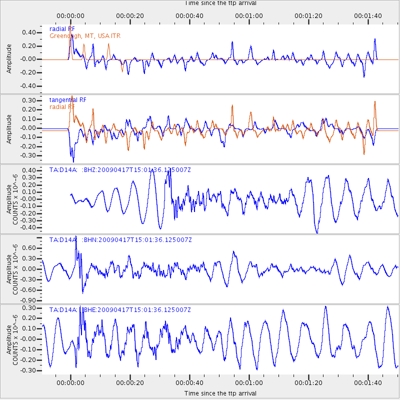
D14A Greenough, MT, USA - Earthquake Result Viewer
*The percent match for this event was below the threshold and hence no stack was calculated.
| Earthquake location: |
Kuril Islands |
| Earthquake latitude/longitude: |
46.2/151.7 |
| Earthquake time(UTC): |
2009/04/17 (107) 14:51:58 GMT |
| Earthquake Depth: |
49 km |
| Earthquake Magnitude: |
5.5 MB, 5.0 MS, 5.7 MW, 5.6 MW |
| Earthquake Catalog/Contributor: |
WHDF/NEIC |
|
| Network: |
TA USArray Transportable Network (new EarthScope stations) |
| Station: |
D14A Greenough, MT, USA |
| Lat/Lon: |
47.08 N/113.51 W |
| Elevation: |
1444 m |
|
| Distance: |
61.0 deg |
| Az: |
51.158 deg |
| Baz: |
307.623 deg |
| Ray Param: |
$rayparam |
*The percent match for this event was below the threshold and hence was not used in the summary stack. |
|
| Radial Match: |
72.87313 % |
| Radial Bump: |
354 |
| Transverse Match: |
62.13669 % |
| Transverse Bump: |
400 |
| SOD ConfigId: |
2658 |
| Insert Time: |
2010-03-06 21:36:00.985 +0000 |
| GWidth: |
2.5 |
| Max Bumps: |
400 |
| Tol: |
0.001 |
|
Signal To Noise
| Channel | StoN | STA | LTA |
| TA:D14A: :BHN:20090417T15:01:36.125007Z | 2.7103097 | 3.7099582E-7 | 1.3688317E-7 |
| TA:D14A: :BHE:20090417T15:01:36.125007Z | 1.0547572 | 1.4347225E-7 | 1.3602396E-7 |
| TA:D14A: :BHZ:20090417T15:01:36.125007Z | 2.1443977 | 2.7555689E-7 | 1.2850082E-7 |
| Arrivals |
| Ps | |
| PpPs | |
| PsPs/PpSs | |


