You are here: Home > Network List > TS - TERRAscope (Southern California Seismic Network) Stations List
> Station DGR Domenigoni Valley Reservior, California, USA > Earthquake Result Viewer
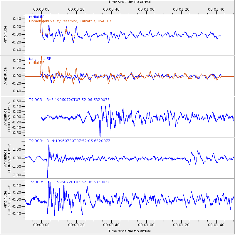
DGR Domenigoni Valley Reservior, California, USA - Earthquake Result Viewer
*The percent match for this event was below the threshold and hence no stack was calculated.
| Earthquake location: |
Fiji Islands Region |
| Earthquake latitude/longitude: |
-19.8/-177.6 |
| Earthquake time(UTC): |
1996/07/20 (202) 07:41:15 GMT |
| Earthquake Depth: |
357 km |
| Earthquake Magnitude: |
5.7 MB, 5.9 UNKNOWN, 5.8 MW |
| Earthquake Catalog/Contributor: |
WHDF/NEIC |
|
| Network: |
TS TERRAscope (Southern California Seismic Network) |
| Station: |
DGR Domenigoni Valley Reservior, California, USA |
| Lat/Lon: |
33.65 N/117.01 W |
| Elevation: |
700 m |
|
| Distance: |
78.5 deg |
| Az: |
47.888 deg |
| Baz: |
236.855 deg |
| Ray Param: |
$rayparam |
*The percent match for this event was below the threshold and hence was not used in the summary stack. |
|
| Radial Match: |
69.654205 % |
| Radial Bump: |
400 |
| Transverse Match: |
58.532112 % |
| Transverse Bump: |
400 |
| SOD ConfigId: |
4480 |
| Insert Time: |
2010-02-26 14:10:55.163 +0000 |
| GWidth: |
2.5 |
| Max Bumps: |
400 |
| Tol: |
0.001 |
|
Signal To Noise
| Channel | StoN | STA | LTA |
| TS:DGR: :BHN:19960720T07:52:06.632007Z | 7.686138 | 7.2835644E-7 | 9.476235E-8 |
| TS:DGR: :BHE:19960720T07:52:06.632007Z | 2.381141 | 1.9325816E-7 | 8.1162E-8 |
| TS:DGR: :BHZ:19960720T07:52:06.632007Z | 3.9355547 | 2.4101422E-7 | 6.124022E-8 |
| Arrivals |
| Ps | |
| PpPs | |
| PsPs/PpSs | |


