You are here: Home > Network List > GS - US Geological Survey Networks Stations List
> Station DEC06 Boomer > Earthquake Result Viewer
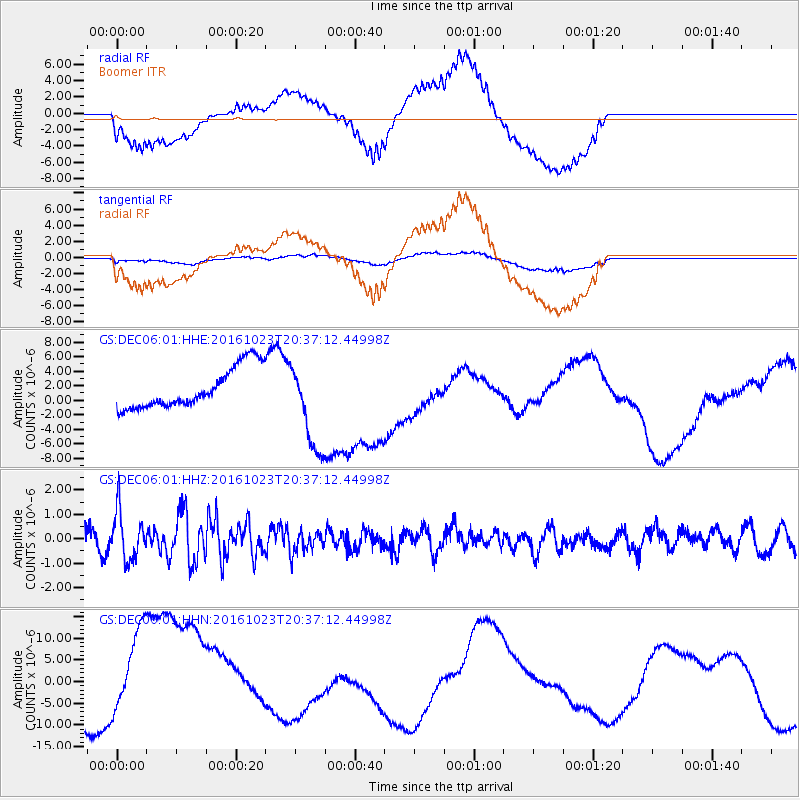
DEC06 Boomer - Earthquake Result Viewer
*The percent match for this event was below the threshold and hence no stack was calculated.
| Earthquake location: |
East Of Kuril Islands |
| Earthquake latitude/longitude: |
44.0/148.2 |
| Earthquake time(UTC): |
2016/10/23 (297) 20:25:26 GMT |
| Earthquake Depth: |
30 km |
| Earthquake Magnitude: |
5.8 MB |
| Earthquake Catalog/Contributor: |
NEIC PDE/NEIC COMCAT |
|
| Network: |
GS US Geological Survey Networks |
| Station: |
DEC06 Boomer |
| Lat/Lon: |
39.90 N/88.95 W |
| Elevation: |
215 m |
|
| Distance: |
81.9 deg |
| Az: |
40.728 deg |
| Baz: |
322.248 deg |
| Ray Param: |
$rayparam |
*The percent match for this event was below the threshold and hence was not used in the summary stack. |
|
| Radial Match: |
66.885956 % |
| Radial Bump: |
400 |
| Transverse Match: |
60.9702 % |
| Transverse Bump: |
400 |
| SOD ConfigId: |
1815711 |
| Insert Time: |
2016-11-06 20:26:49.539 +0000 |
| GWidth: |
2.5 |
| Max Bumps: |
400 |
| Tol: |
0.001 |
|
Signal To Noise
| Channel | StoN | STA | LTA |
| GS:DEC06:01:HHZ:20161023T20:37:12.44998Z | 3.383813 | 9.839608E-7 | 2.9078467E-7 |
| GS:DEC06:01:HHN:20161023T20:37:12.44998Z | 2.2807195 | 1.1107986E-5 | 4.8703864E-6 |
| GS:DEC06:01:HHE:20161023T20:37:12.44998Z | 2.1667354 | 6.014355E-6 | 2.7757683E-6 |
| Arrivals |
| Ps | |
| PpPs | |
| PsPs/PpSs | |


