You are here: Home > Network List > TA - USArray Transportable Network (new EarthScope stations) Stations List
> Station D14A Greenough, MT, USA > Earthquake Result Viewer
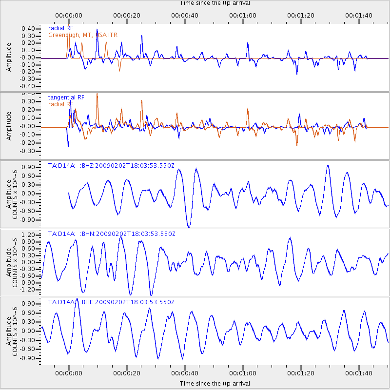
D14A Greenough, MT, USA - Earthquake Result Viewer
*The percent match for this event was below the threshold and hence no stack was calculated.
| Earthquake location: |
Near Coast Of Peru |
| Earthquake latitude/longitude: |
-13.6/-76.6 |
| Earthquake time(UTC): |
2009/02/02 (033) 17:53:21 GMT |
| Earthquake Depth: |
21 km |
| Earthquake Magnitude: |
5.6 MB, 5.6 MS, 6.0 MW, 5.9 MW |
| Earthquake Catalog/Contributor: |
WHDF/NEIC |
|
| Network: |
TA USArray Transportable Network (new EarthScope stations) |
| Station: |
D14A Greenough, MT, USA |
| Lat/Lon: |
47.08 N/113.51 W |
| Elevation: |
1444 m |
|
| Distance: |
68.9 deg |
| Az: |
333.868 deg |
| Baz: |
141.193 deg |
| Ray Param: |
$rayparam |
*The percent match for this event was below the threshold and hence was not used in the summary stack. |
|
| Radial Match: |
84.71682 % |
| Radial Bump: |
338 |
| Transverse Match: |
51.984737 % |
| Transverse Bump: |
365 |
| SOD ConfigId: |
6627 |
| Insert Time: |
2010-03-06 21:37:12.201 +0000 |
| GWidth: |
2.5 |
| Max Bumps: |
400 |
| Tol: |
0.001 |
|
Signal To Noise
| Channel | StoN | STA | LTA |
| TA:D14A: :BHN:20090202T18:03:53.550Z | 1.9100361 | 7.5069005E-7 | 3.9302404E-7 |
| TA:D14A: :BHE:20090202T18:03:53.550Z | 1.911648 | 6.498195E-7 | 3.3992634E-7 |
| TA:D14A: :BHZ:20090202T18:03:53.550Z | 0.5391486 | 1.8025798E-7 | 3.343382E-7 |
| Arrivals |
| Ps | |
| PpPs | |
| PsPs/PpSs | |


