You are here: Home > Network List > GS - US Geological Survey Networks Stations List
> Station KAN13 Rinehart Farm > Earthquake Result Viewer
KAN13 Rinehart Farm - Earthquake Result Viewer
*The percent match for this event was below the threshold and hence no stack was calculated.
| Earthquake location: |
East Of Kuril Islands |
| Earthquake latitude/longitude: |
44.0/148.2 |
| Earthquake time(UTC): |
2016/10/23 (297) 20:25:26 GMT |
| Earthquake Depth: |
30 km |
| Earthquake Magnitude: |
5.8 MB |
| Earthquake Catalog/Contributor: |
NEIC PDE/NEIC COMCAT |
|
| Network: |
GS US Geological Survey Networks |
| Station: |
KAN13 Rinehart Farm |
| Lat/Lon: |
37.01 N/97.48 W |
| Elevation: |
340 m |
|
| Distance: |
79.8 deg |
| Az: |
47.8 deg |
| Baz: |
318.079 deg |
| Ray Param: |
$rayparam |
*The percent match for this event was below the threshold and hence was not used in the summary stack. |
|
| Radial Match: |
37.658474 % |
| Radial Bump: |
400 |
| Transverse Match: |
29.972343 % |
| Transverse Bump: |
400 |
| SOD ConfigId: |
1815711 |
| Insert Time: |
2016-11-06 20:27:00.860 +0000 |
| GWidth: |
2.5 |
| Max Bumps: |
400 |
| Tol: |
0.001 |
|
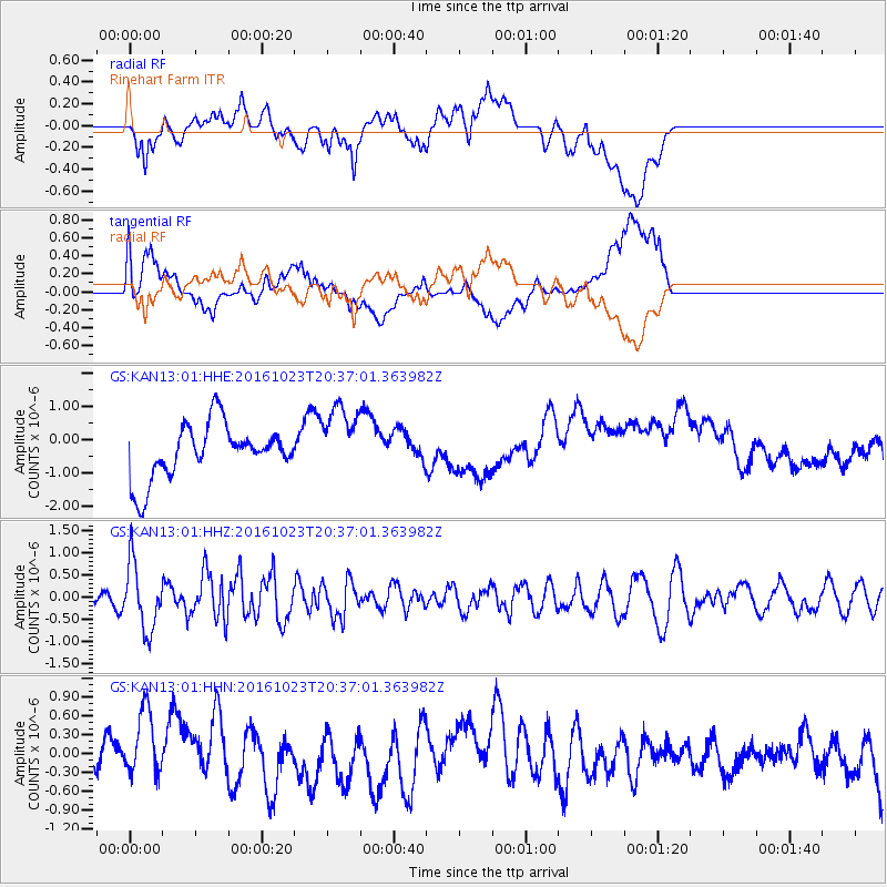
Signal To Noise
| Channel | StoN | STA | LTA |
| GS:KAN13:01:HHZ:20161023T20:37:01.363982Z | 2.5002754 | 7.4621965E-7 | 2.9845498E-7 |
| GS:KAN13:01:HHN:20161023T20:37:01.363982Z | 1.7920127 | 5.8107713E-7 | 3.242595E-7 |
| GS:KAN13:01:HHE:20161023T20:37:01.363982Z | 1.3086842 | 1.0706415E-6 | 8.181052E-7 |
| Arrivals |
| Ps | |
| PpPs | |
| PsPs/PpSs | |


