You are here: Home > Network List > IU - Global Seismograph Network (GSN - IRIS/USGS) Stations List
> Station JOHN Johnston Island, USA > Earthquake Result Viewer
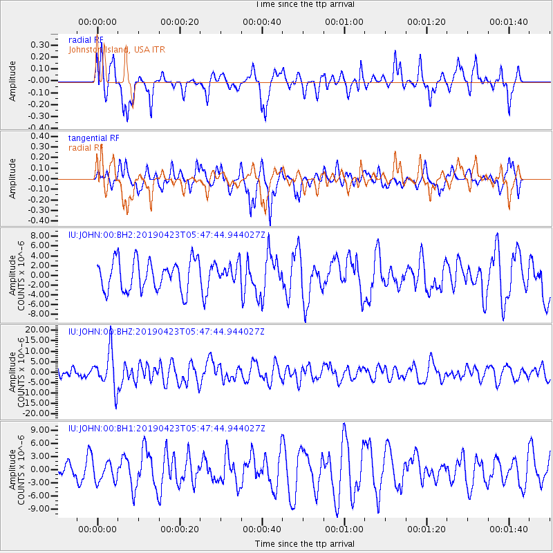
JOHN Johnston Island, USA - Earthquake Result Viewer
*The percent match for this event was below the threshold and hence no stack was calculated.
| Earthquake location: |
Samar, Philippines |
| Earthquake latitude/longitude: |
11.8/125.2 |
| Earthquake time(UTC): |
2019/04/23 (113) 05:37:52 GMT |
| Earthquake Depth: |
54 km |
| Earthquake Magnitude: |
6.4 Mww |
| Earthquake Catalog/Contributor: |
NEIC PDE/us |
|
| Network: |
IU Global Seismograph Network (GSN - IRIS/USGS) |
| Station: |
JOHN Johnston Island, USA |
| Lat/Lon: |
16.73 N/169.53 W |
| Elevation: |
2.0 m |
|
| Distance: |
63.2 deg |
| Az: |
77.159 deg |
| Baz: |
275.032 deg |
| Ray Param: |
$rayparam |
*The percent match for this event was below the threshold and hence was not used in the summary stack. |
|
| Radial Match: |
72.530266 % |
| Radial Bump: |
400 |
| Transverse Match: |
59.937363 % |
| Transverse Bump: |
400 |
| SOD ConfigId: |
18252611 |
| Insert Time: |
2019-05-07 05:40:50.427 +0000 |
| GWidth: |
2.5 |
| Max Bumps: |
400 |
| Tol: |
0.001 |
|
Signal To Noise
| Channel | StoN | STA | LTA |
| IU:JOHN:00:BHZ:20190423T05:47:44.944027Z | 4.2056837 | 9.087653E-6 | 2.1608028E-6 |
| IU:JOHN:00:BH1:20190423T05:47:44.944027Z | 1.474021 | 2.2094264E-6 | 1.4989112E-6 |
| IU:JOHN:00:BH2:20190423T05:47:44.944027Z | 0.5994454 | 1.8684675E-6 | 3.1169934E-6 |
| Arrivals |
| Ps | |
| PpPs | |
| PsPs/PpSs | |


