You are here: Home > Network List > US - United States National Seismic Network Stations List
> Station AMTX Amarillo, Texas, USA > Earthquake Result Viewer
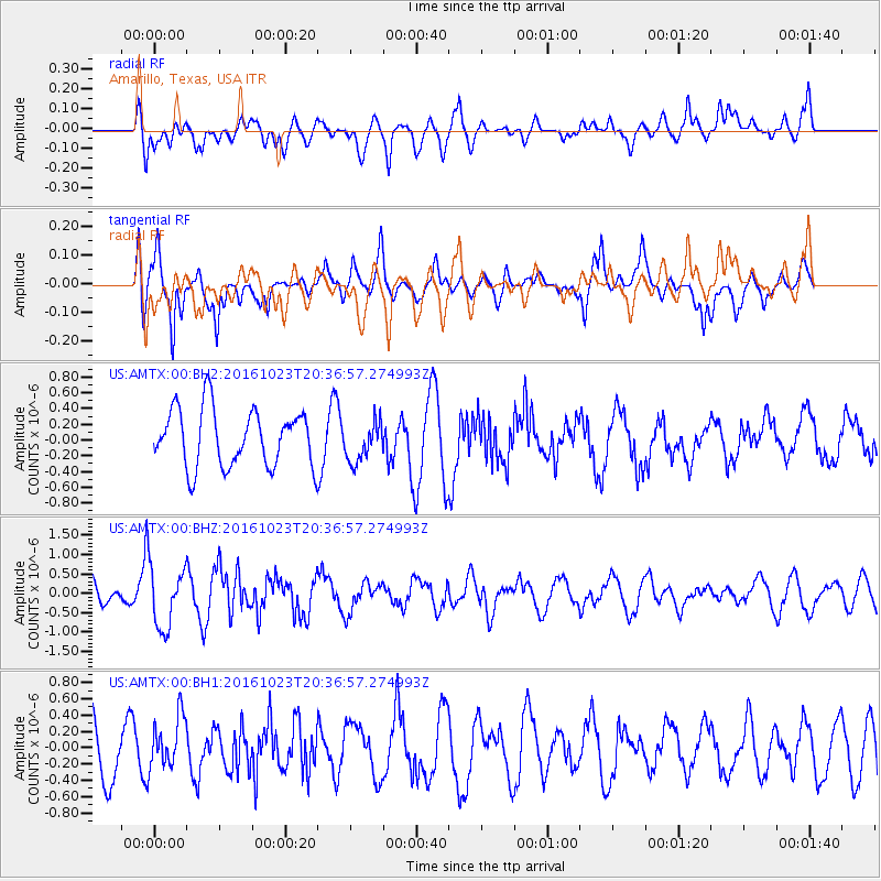
AMTX Amarillo, Texas, USA - Earthquake Result Viewer
*The percent match for this event was below the threshold and hence no stack was calculated.
| Earthquake location: |
East Of Kuril Islands |
| Earthquake latitude/longitude: |
44.0/148.2 |
| Earthquake time(UTC): |
2016/10/23 (297) 20:25:26 GMT |
| Earthquake Depth: |
30 km |
| Earthquake Magnitude: |
5.8 MB |
| Earthquake Catalog/Contributor: |
NEIC PDE/NEIC COMCAT |
|
| Network: |
US United States National Seismic Network |
| Station: |
AMTX Amarillo, Texas, USA |
| Lat/Lon: |
34.53 N/101.41 W |
| Elevation: |
1010 m |
|
| Distance: |
79.5 deg |
| Az: |
51.894 deg |
| Baz: |
316.526 deg |
| Ray Param: |
$rayparam |
*The percent match for this event was below the threshold and hence was not used in the summary stack. |
|
| Radial Match: |
56.07806 % |
| Radial Bump: |
400 |
| Transverse Match: |
66.77106 % |
| Transverse Bump: |
388 |
| SOD ConfigId: |
1815711 |
| Insert Time: |
2016-11-06 20:29:17.278 +0000 |
| GWidth: |
2.5 |
| Max Bumps: |
400 |
| Tol: |
0.001 |
|
Signal To Noise
| Channel | StoN | STA | LTA |
| US:AMTX:00:BHZ:20161023T20:36:57.274993Z | 1.7280123 | 8.179406E-7 | 4.7334188E-7 |
| US:AMTX:00:BH1:20161023T20:36:57.274993Z | 0.9283908 | 3.281097E-7 | 3.5341768E-7 |
| US:AMTX:00:BH2:20161023T20:36:57.274993Z | 0.56306386 | 2.1583898E-7 | 3.833295E-7 |
| Arrivals |
| Ps | |
| PpPs | |
| PsPs/PpSs | |


