You are here: Home > Network List > TS - TERRAscope (Southern California Seismic Network) Stations List
> Station DGR Domenigoni Valley Reservior, California, USA > Earthquake Result Viewer
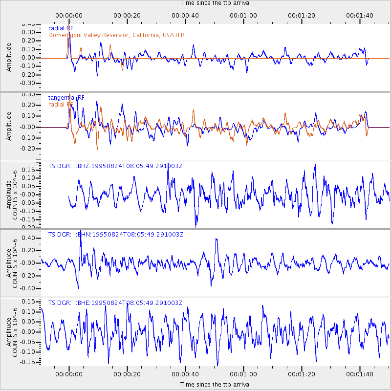
DGR Domenigoni Valley Reservior, California, USA - Earthquake Result Viewer
*The percent match for this event was below the threshold and hence no stack was calculated.
| Earthquake location: |
Mariana Islands |
| Earthquake latitude/longitude: |
18.9/145.0 |
| Earthquake time(UTC): |
1995/08/24 (236) 07:54:41 GMT |
| Earthquake Depth: |
598 km |
| Earthquake Magnitude: |
5.3 MB, 6.1 UNKNOWN |
| Earthquake Catalog/Contributor: |
WHDF/NEIC |
|
| Network: |
TS TERRAscope (Southern California Seismic Network) |
| Station: |
DGR Domenigoni Valley Reservior, California, USA |
| Lat/Lon: |
33.65 N/117.01 W |
| Elevation: |
700 m |
|
| Distance: |
86.2 deg |
| Az: |
55.882 deg |
| Baz: |
289.97 deg |
| Ray Param: |
$rayparam |
*The percent match for this event was below the threshold and hence was not used in the summary stack. |
|
| Radial Match: |
59.526955 % |
| Radial Bump: |
400 |
| Transverse Match: |
66.24973 % |
| Transverse Bump: |
400 |
| SOD ConfigId: |
4480 |
| Insert Time: |
2010-02-26 14:10:57.878 +0000 |
| GWidth: |
2.5 |
| Max Bumps: |
400 |
| Tol: |
0.001 |
|
Signal To Noise
| Channel | StoN | STA | LTA |
| TS:DGR: :BHN:19950824T08:05:49.291003Z | 3.1026933 | 1.7857673E-7 | 5.755539E-8 |
| TS:DGR: :BHE:19950824T08:05:49.291003Z | 0.93099034 | 4.913922E-8 | 5.2781665E-8 |
| TS:DGR: :BHZ:19950824T08:05:49.291003Z | 1.3731883 | 6.652647E-8 | 4.844672E-8 |
| Arrivals |
| Ps | |
| PpPs | |
| PsPs/PpSs | |


