You are here: Home > Network List > TA - USArray Transportable Network (new EarthScope stations) Stations List
> Station M15A Larsen Ranch, Promontory, UT, USA > Earthquake Result Viewer
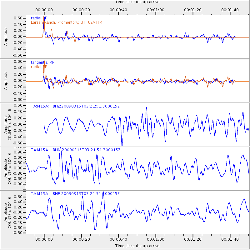
M15A Larsen Ranch, Promontory, UT, USA - Earthquake Result Viewer

| Earthquake location: |
Galapagos Islands Region |
| Earthquake latitude/longitude: |
2.4/-95.1 |
| Earthquake time(UTC): |
2009/03/15 (074) 03:14:31 GMT |
| Earthquake Depth: |
10 km |
| Earthquake Magnitude: |
5.5 MS, 5.4 MB, 5.8 MW, 5.8 MW |
| Earthquake Catalog/Contributor: |
WHDF/NEIC |
|
| Network: |
TA USArray Transportable Network (new EarthScope stations) |
| Station: |
M15A Larsen Ranch, Promontory, UT, USA |
| Lat/Lon: |
41.46 N/112.45 W |
| Elevation: |
1348 m |
|
| Distance: |
41.9 deg |
| Az: |
340.41 deg |
| Baz: |
153.531 deg |
| Ray Param: |
0.07351559 |
| Estimated Moho Depth: |
10.0 km |
| Estimated Crust Vp/Vs: |
1.71 |
| Assumed Crust Vp: |
6.276 km/s |
| Estimated Crust Vs: |
3.67 km/s |
| Estimated Crust Poisson's Ratio: |
0.24 |
|
| Radial Match: |
82.895294 % |
| Radial Bump: |
400 |
| Transverse Match: |
59.683357 % |
| Transverse Bump: |
400 |
| SOD ConfigId: |
2658 |
| Insert Time: |
2010-03-06 21:39:28.746 +0000 |
| GWidth: |
2.5 |
| Max Bumps: |
400 |
| Tol: |
0.001 |
|
Signal To Noise
| Channel | StoN | STA | LTA |
| TA:M15A: :BHN:20090315T03:21:51.300015Z | 2.9862206 | 3.9275744E-7 | 1.3152325E-7 |
| TA:M15A: :BHE:20090315T03:21:51.300015Z | 1.7460876 | 2.838064E-7 | 1.6253847E-7 |
| TA:M15A: :BHZ:20090315T03:21:51.300015Z | 1.0694722 | 1.5865119E-7 | 1.4834532E-7 |
| Arrivals |
| Ps | 1.2 SECOND |
| PpPs | 4.0 SECOND |
| PsPs/PpSs | 5.2 SECOND |


