You are here: Home > Network List > TA - USArray Transportable Network (new EarthScope stations) Stations List
> Station I17K Unalakleet, AK, USA > Earthquake Result Viewer
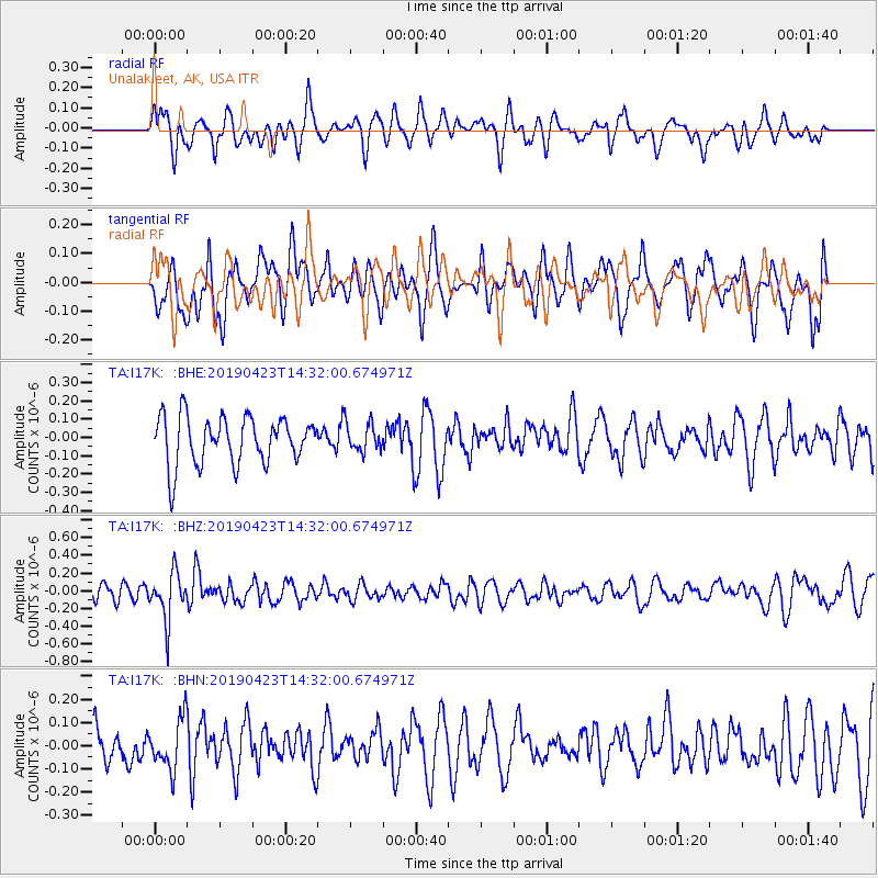
I17K Unalakleet, AK, USA - Earthquake Result Viewer
*The percent match for this event was below the threshold and hence no stack was calculated.
| Earthquake location: |
South Of Fiji Islands |
| Earthquake latitude/longitude: |
-24.7/-178.8 |
| Earthquake time(UTC): |
2019/04/23 (113) 14:20:17 GMT |
| Earthquake Depth: |
386 km |
| Earthquake Magnitude: |
6.0 Mww |
| Earthquake Catalog/Contributor: |
NEIC PDE/us |
|
| Network: |
TA USArray Transportable Network (new EarthScope stations) |
| Station: |
I17K Unalakleet, AK, USA |
| Lat/Lon: |
63.89 N/160.70 W |
| Elevation: |
105 m |
|
| Distance: |
89.4 deg |
| Az: |
7.89 deg |
| Baz: |
196.386 deg |
| Ray Param: |
$rayparam |
*The percent match for this event was below the threshold and hence was not used in the summary stack. |
|
| Radial Match: |
61.152245 % |
| Radial Bump: |
400 |
| Transverse Match: |
47.392014 % |
| Transverse Bump: |
400 |
| SOD ConfigId: |
18252611 |
| Insert Time: |
2019-05-07 14:25:43.731 +0000 |
| GWidth: |
2.5 |
| Max Bumps: |
400 |
| Tol: |
0.001 |
|
Signal To Noise
| Channel | StoN | STA | LTA |
| TA:I17K: :BHZ:20190423T14:32:00.674971Z | 2.3923702 | 2.67309E-7 | 1.11733954E-7 |
| TA:I17K: :BHN:20190423T14:32:00.674971Z | 1.1611552 | 1.06906526E-7 | 9.2069115E-8 |
| TA:I17K: :BHE:20190423T14:32:00.674971Z | 0.5929718 | 7.667893E-8 | 1.2931294E-7 |
| Arrivals |
| Ps | |
| PpPs | |
| PsPs/PpSs | |


