You are here: Home > Network List > TS - TERRAscope (Southern California Seismic Network) Stations List
> Station DGR Domenigoni Valley Reservior, California, USA > Earthquake Result Viewer
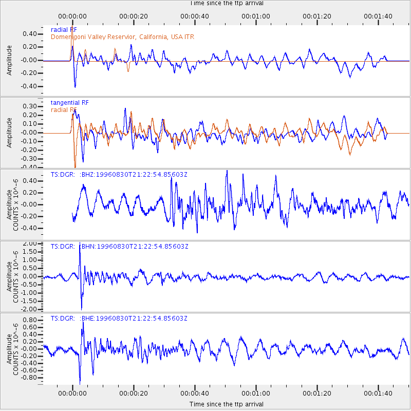
DGR Domenigoni Valley Reservior, California, USA - Earthquake Result Viewer
*The percent match for this event was below the threshold and hence no stack was calculated.
| Earthquake location: |
Sea Of Okhotsk |
| Earthquake latitude/longitude: |
52.3/151.5 |
| Earthquake time(UTC): |
1996/08/30 (243) 21:13:41 GMT |
| Earthquake Depth: |
580 km |
| Earthquake Magnitude: |
5.5 UNKNOWN, 5.1 MB, 5.4 MW |
| Earthquake Catalog/Contributor: |
WHDF/NEIC |
|
| Network: |
TS TERRAscope (Southern California Seismic Network) |
| Station: |
DGR Domenigoni Valley Reservior, California, USA |
| Lat/Lon: |
33.65 N/117.01 W |
| Elevation: |
700 m |
|
| Distance: |
65.0 deg |
| Az: |
66.889 deg |
| Baz: |
317.403 deg |
| Ray Param: |
$rayparam |
*The percent match for this event was below the threshold and hence was not used in the summary stack. |
|
| Radial Match: |
58.031017 % |
| Radial Bump: |
400 |
| Transverse Match: |
71.572 % |
| Transverse Bump: |
400 |
| SOD ConfigId: |
4480 |
| Insert Time: |
2010-02-26 14:11:04.012 +0000 |
| GWidth: |
2.5 |
| Max Bumps: |
400 |
| Tol: |
0.001 |
|
Signal To Noise
| Channel | StoN | STA | LTA |
| TS:DGR: :BHN:19960830T21:22:54.85603Z | 6.3998966 | 7.0312825E-7 | 1.0986556E-7 |
| TS:DGR: :BHE:19960830T21:22:54.85603Z | 3.04402 | 3.173322E-7 | 1.04247746E-7 |
| TS:DGR: :BHZ:19960830T21:22:54.85603Z | 1.6771244 | 2.3276503E-7 | 1.3878817E-7 |
| Arrivals |
| Ps | |
| PpPs | |
| PsPs/PpSs | |


