You are here: Home > Network List > IW - Intermountain West Stations List
> Station DLMT Dillon, Montana, USA > Earthquake Result Viewer
DLMT Dillon, Montana, USA - Earthquake Result Viewer
*The percent match for this event was below the threshold and hence no stack was calculated.
| Earthquake location: |
Tonga Islands |
| Earthquake latitude/longitude: |
-15.5/-174.9 |
| Earthquake time(UTC): |
2016/10/26 (300) 05:19:50 GMT |
| Earthquake Depth: |
10 km |
| Earthquake Magnitude: |
6.1 MWW, 6.1 MWC |
| Earthquake Catalog/Contributor: |
NEIC PDE/NEIC COMCAT |
|
| Network: |
IW Intermountain West |
| Station: |
DLMT Dillon, Montana, USA |
| Lat/Lon: |
45.36 N/112.60 W |
| Elevation: |
1569 m |
|
| Distance: |
82.7 deg |
| Az: |
38.99 deg |
| Baz: |
239.345 deg |
| Ray Param: |
$rayparam |
*The percent match for this event was below the threshold and hence was not used in the summary stack. |
|
| Radial Match: |
50.301525 % |
| Radial Bump: |
400 |
| Transverse Match: |
64.845184 % |
| Transverse Bump: |
400 |
| SOD ConfigId: |
1815711 |
| Insert Time: |
2016-11-09 05:21:59.684 +0000 |
| GWidth: |
2.5 |
| Max Bumps: |
400 |
| Tol: |
0.001 |
|
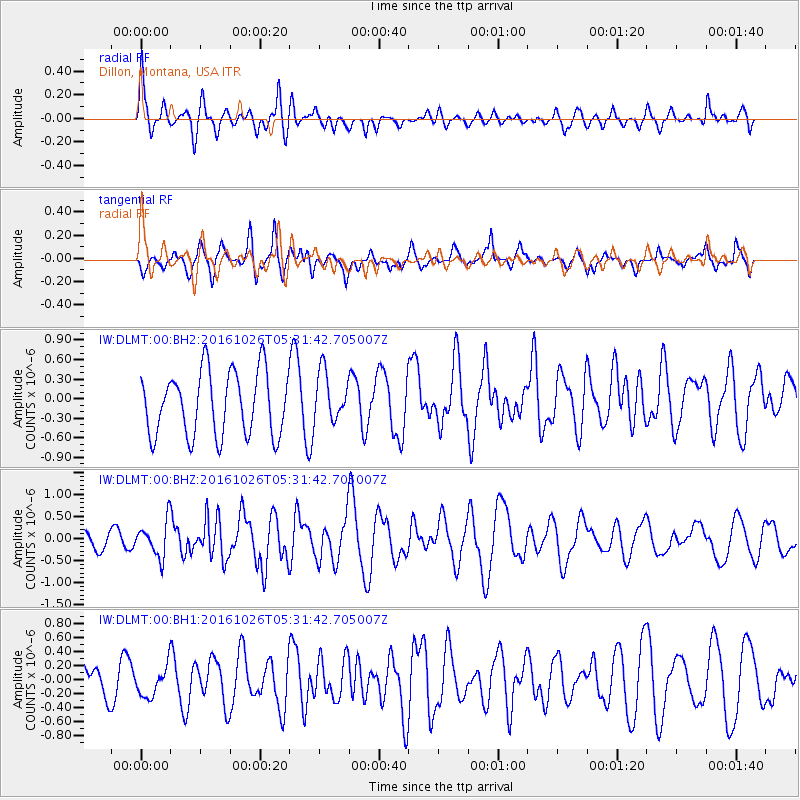
Signal To Noise
| Channel | StoN | STA | LTA |
| IW:DLMT:00:BHZ:20161026T05:31:42.705007Z | 2.7081249 | 4.098792E-7 | 1.5135166E-7 |
| IW:DLMT:00:BH1:20161026T05:31:42.705007Z | 0.6790835 | 2.2961288E-7 | 3.381217E-7 |
| IW:DLMT:00:BH2:20161026T05:31:42.705007Z | 0.7787581 | 3.8125987E-7 | 4.895742E-7 |
| Arrivals |
| Ps | |
| PpPs | |
| PsPs/PpSs | |


