You are here: Home > Network List > UW - Pacific Northwest Regional Seismic Network Stations List
> Station UMAT Pilot Rock, OR, USA > Earthquake Result Viewer
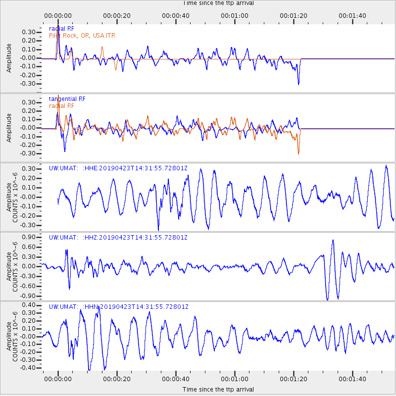
UMAT Pilot Rock, OR, USA - Earthquake Result Viewer
*The percent match for this event was below the threshold and hence no stack was calculated.
| Earthquake location: |
South Of Fiji Islands |
| Earthquake latitude/longitude: |
-24.7/-178.8 |
| Earthquake time(UTC): |
2019/04/23 (113) 14:20:17 GMT |
| Earthquake Depth: |
386 km |
| Earthquake Magnitude: |
6.0 Mww |
| Earthquake Catalog/Contributor: |
NEIC PDE/us |
|
| Network: |
UW Pacific Northwest Regional Seismic Network |
| Station: |
UMAT Pilot Rock, OR, USA |
| Lat/Lon: |
45.29 N/118.96 W |
| Elevation: |
1318 m |
|
| Distance: |
88.4 deg |
| Az: |
37.616 deg |
| Baz: |
231.854 deg |
| Ray Param: |
$rayparam |
*The percent match for this event was below the threshold and hence was not used in the summary stack. |
|
| Radial Match: |
48.57092 % |
| Radial Bump: |
352 |
| Transverse Match: |
64.39573 % |
| Transverse Bump: |
400 |
| SOD ConfigId: |
18252611 |
| Insert Time: |
2019-05-07 14:27:37.381 +0000 |
| GWidth: |
2.5 |
| Max Bumps: |
400 |
| Tol: |
0.001 |
|
Signal To Noise
| Channel | StoN | STA | LTA |
| UW:UMAT: :HHZ:20190423T14:31:55.72801Z | 2.942838 | 2.6016693E-7 | 8.840682E-8 |
| UW:UMAT: :HHN:20190423T14:31:55.72801Z | 0.8957353 | 1.4656315E-7 | 1.6362328E-7 |
| UW:UMAT: :HHE:20190423T14:31:55.72801Z | 1.1850747 | 1.2340868E-7 | 1.04135786E-7 |
| Arrivals |
| Ps | |
| PpPs | |
| PsPs/PpSs | |


