You are here: Home > Network List > US - United States National Seismic Network Stations List
> Station BOZ Bozeman, Montana, USA > Earthquake Result Viewer
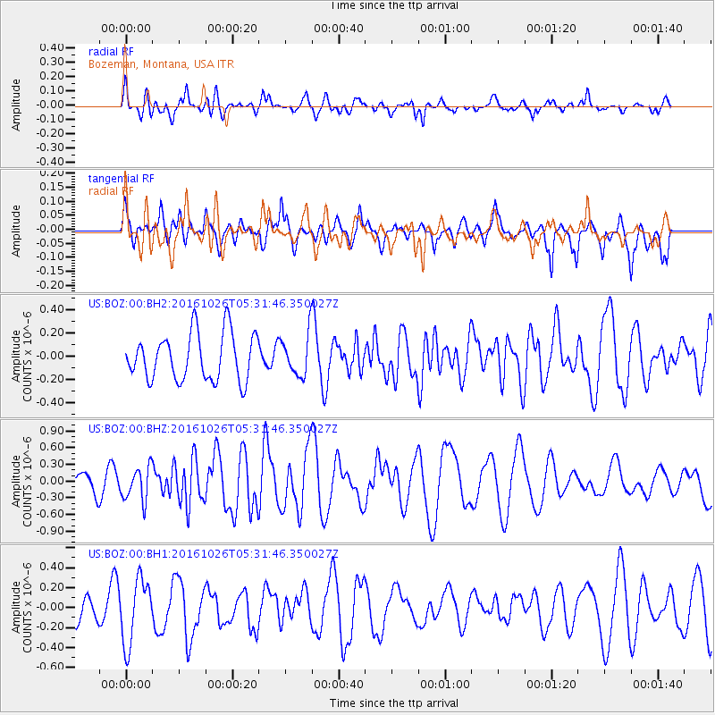
BOZ Bozeman, Montana, USA - Earthquake Result Viewer
*The percent match for this event was below the threshold and hence no stack was calculated.
| Earthquake location: |
Tonga Islands |
| Earthquake latitude/longitude: |
-15.5/-174.9 |
| Earthquake time(UTC): |
2016/10/26 (300) 05:19:50 GMT |
| Earthquake Depth: |
10 km |
| Earthquake Magnitude: |
6.1 MWW, 6.1 MWC |
| Earthquake Catalog/Contributor: |
NEIC PDE/NEIC COMCAT |
|
| Network: |
US United States National Seismic Network |
| Station: |
BOZ Bozeman, Montana, USA |
| Lat/Lon: |
45.65 N/111.63 W |
| Elevation: |
1589 m |
|
| Distance: |
83.4 deg |
| Az: |
39.089 deg |
| Baz: |
240.044 deg |
| Ray Param: |
$rayparam |
*The percent match for this event was below the threshold and hence was not used in the summary stack. |
|
| Radial Match: |
59.270462 % |
| Radial Bump: |
400 |
| Transverse Match: |
44.91233 % |
| Transverse Bump: |
400 |
| SOD ConfigId: |
1815711 |
| Insert Time: |
2016-11-09 05:22:36.423 +0000 |
| GWidth: |
2.5 |
| Max Bumps: |
400 |
| Tol: |
0.001 |
|
Signal To Noise
| Channel | StoN | STA | LTA |
| US:BOZ:00:BHZ:20161026T05:31:46.350027Z | 1.7452645 | 3.0174272E-7 | 1.7289224E-7 |
| US:BOZ:00:BH1:20161026T05:31:46.350027Z | 1.3965106 | 3.289857E-7 | 2.3557695E-7 |
| US:BOZ:00:BH2:20161026T05:31:46.350027Z | 0.9507076 | 1.9145877E-7 | 2.0138555E-7 |
| Arrivals |
| Ps | |
| PpPs | |
| PsPs/PpSs | |


