You are here: Home > Network List > AV - Alaska Volcano Observatory Stations List
> Station SPCR Ckakachatna River, Mount Spurr, Alaska > Earthquake Result Viewer
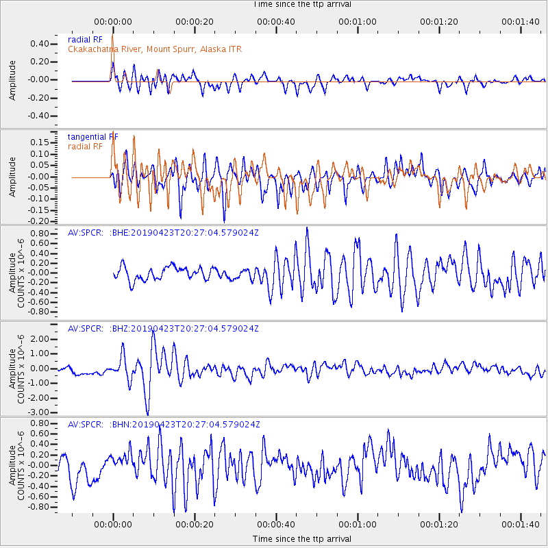
SPCR Ckakachatna River, Mount Spurr, Alaska - Earthquake Result Viewer
*The percent match for this event was below the threshold and hence no stack was calculated.
| Earthquake location: |
Eastern Xizang-India Border Reg. |
| Earthquake latitude/longitude: |
28.4/94.6 |
| Earthquake time(UTC): |
2019/04/23 (113) 20:15:50 GMT |
| Earthquake Depth: |
14 km |
| Earthquake Magnitude: |
5.9 Mww |
| Earthquake Catalog/Contributor: |
NEIC PDE/us |
|
| Network: |
AV Alaska Volcano Observatory |
| Station: |
SPCR Ckakachatna River, Mount Spurr, Alaska |
| Lat/Lon: |
61.20 N/152.21 W |
| Elevation: |
984 m |
|
| Distance: |
75.7 deg |
| Az: |
27.338 deg |
| Baz: |
303.343 deg |
| Ray Param: |
$rayparam |
*The percent match for this event was below the threshold and hence was not used in the summary stack. |
|
| Radial Match: |
79.997025 % |
| Radial Bump: |
400 |
| Transverse Match: |
68.89575 % |
| Transverse Bump: |
400 |
| SOD ConfigId: |
18252611 |
| Insert Time: |
2019-05-07 20:17:15.047 +0000 |
| GWidth: |
2.5 |
| Max Bumps: |
400 |
| Tol: |
0.001 |
|
Signal To Noise
| Channel | StoN | STA | LTA |
| AV:SPCR: :BHZ:20190423T20:27:04.579024Z | 4.044922 | 7.7706443E-7 | 1.9210864E-7 |
| AV:SPCR: :BHN:20190423T20:27:04.579024Z | 1.0934006 | 2.1611251E-7 | 1.9765173E-7 |
| AV:SPCR: :BHE:20190423T20:27:04.579024Z | 0.7805497 | 1.0171611E-7 | 1.3031344E-7 |
| Arrivals |
| Ps | |
| PpPs | |
| PsPs/PpSs | |


