You are here: Home > Network List > TA - USArray Transportable Network (new EarthScope stations) Stations List
> Station T15A Red Dirt Ranch, Kanab, UT, USA > Earthquake Result Viewer
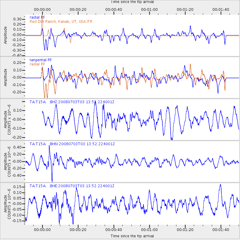
T15A Red Dirt Ranch, Kanab, UT, USA - Earthquake Result Viewer
*The percent match for this event was below the threshold and hence no stack was calculated.
| Earthquake location: |
South Of Fiji Islands |
| Earthquake latitude/longitude: |
-23.4/-179.8 |
| Earthquake time(UTC): |
2008/07/03 (185) 03:02:37 GMT |
| Earthquake Depth: |
581 km |
| Earthquake Magnitude: |
5.6 MB, 6.2 MW, 6.2 MW |
| Earthquake Catalog/Contributor: |
WHDF/NEIC |
|
| Network: |
TA USArray Transportable Network (new EarthScope stations) |
| Station: |
T15A Red Dirt Ranch, Kanab, UT, USA |
| Lat/Lon: |
37.02 N/112.38 W |
| Elevation: |
1561 m |
|
| Distance: |
87.3 deg |
| Az: |
47.705 deg |
| Baz: |
238.13 deg |
| Ray Param: |
$rayparam |
*The percent match for this event was below the threshold and hence was not used in the summary stack. |
|
| Radial Match: |
61.033123 % |
| Radial Bump: |
323 |
| Transverse Match: |
53.583252 % |
| Transverse Bump: |
400 |
| SOD ConfigId: |
2504 |
| Insert Time: |
2010-03-06 21:44:08.080 +0000 |
| GWidth: |
2.5 |
| Max Bumps: |
400 |
| Tol: |
0.001 |
|
Signal To Noise
| Channel | StoN | STA | LTA |
| TA:T15A: :BHN:20080703T03:13:52.224001Z | 2.0277934 | 1.5498053E-7 | 7.6428165E-8 |
| TA:T15A: :BHE:20080703T03:13:52.224001Z | 0.69410205 | 4.109098E-8 | 5.92002E-8 |
| TA:T15A: :BHZ:20080703T03:13:52.224001Z | 1.8313302 | 1.3304815E-7 | 7.26511E-8 |
| Arrivals |
| Ps | |
| PpPs | |
| PsPs/PpSs | |


