You are here: Home > Network List > TS - TERRAscope (Southern California Seismic Network) Stations List
> Station DGR Domenigoni Valley Reservior, California, USA > Earthquake Result Viewer
DGR Domenigoni Valley Reservior, California, USA - Earthquake Result Viewer
*The percent match for this event was below the threshold and hence no stack was calculated.
| Earthquake location: |
Fiji Islands Region |
| Earthquake latitude/longitude: |
-17.8/-178.8 |
| Earthquake time(UTC): |
1993/10/11 (284) 13:07:29 GMT |
| Earthquake Depth: |
556 km |
| Earthquake Magnitude: |
5.9 MB |
| Earthquake Catalog/Contributor: |
WHDF/NEIC |
|
| Network: |
TS TERRAscope (Southern California Seismic Network) |
| Station: |
DGR Domenigoni Valley Reservior, California, USA |
| Lat/Lon: |
33.65 N/117.01 W |
| Elevation: |
700 m |
|
| Distance: |
78.0 deg |
| Az: |
48.704 deg |
| Baz: |
239.106 deg |
| Ray Param: |
$rayparam |
*The percent match for this event was below the threshold and hence was not used in the summary stack. |
|
| Radial Match: |
44.92979 % |
| Radial Bump: |
400 |
| Transverse Match: |
34.859818 % |
| Transverse Bump: |
400 |
| SOD ConfigId: |
4480 |
| Insert Time: |
2010-02-26 14:11:08.348 +0000 |
| GWidth: |
2.5 |
| Max Bumps: |
400 |
| Tol: |
0.001 |
|
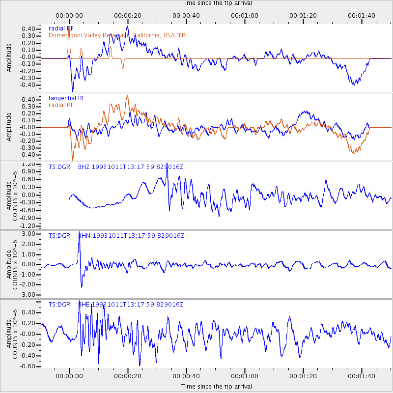
Signal To Noise
| Channel | StoN | STA | LTA |
| TS:DGR: :BHN:19931011T13:17:59.829016Z | 6.4136457 | 1.088666E-6 | 1.6974214E-7 |
| TS:DGR: :BHE:19931011T13:17:59.829016Z | 0.835999 | 2.7312058E-7 | 3.2669965E-7 |
| TS:DGR: :BHZ:19931011T13:17:59.829016Z | 3.6243672 | 7.672409E-7 | 2.1168961E-7 |
| Arrivals |
| Ps | |
| PpPs | |
| PsPs/PpSs | |


