L16A Fish Haven, ID, USA - Earthquake Result Viewer
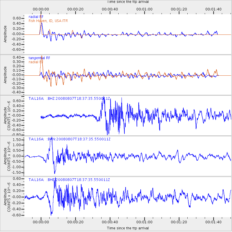
Earthquake location: Andreanof Islands, Aleutian Is.
Earthquake latitude/longitude: 52.2/-175.7
Earthquake time(UTC): 2008/08/07 (220) 18:30:03 GMT
Earthquake Depth: 12 km
Earthquake Magnitude: 5.6 MB, 5.5 MS, 5.8 MW, 5.8 MW
Earthquake Catalog/Contributor: WHDF/NEIC
Network: TA USArray Transportable Network (new EarthScope stations)
Station: L16A Fish Haven, ID, USA
Lat/Lon: 42.01 N/111.43 W
Elevation: 2013 m
Distance: 43.5 deg
Az: 76.985 deg
Baz: 306.401 deg
Ray Param: 0.07248882
Estimated Moho Depth: 12.0 km
Estimated Crust Vp/Vs: 1.60
Assumed Crust Vp: 6.207 km/s
Estimated Crust Vs: 3.873 km/s
Estimated Crust Poisson's Ratio: 0.18
Radial Match: 87.68642 %
Radial Bump: 400
Transverse Match: 66.048836 %
Transverse Bump: 400
SOD ConfigId: 2504
Insert Time: 2010-03-06 21:47:52.135 +0000
GWidth: 2.5
Max Bumps: 400
Tol: 0.001

Signal To Noise

ChannelStoNSTALTA
TA:L16A: :BHN:20080807T18:37:35.550011Z6.9910672.8112672E-74.0212274E-8
TA:L16A: :BHE:20080807T18:37:35.550011Z1.80689449.6978475E-85.3671357E-8
TA:L16A: :BHZ:20080807T18:37:35.550011Z3.18239641.1709186E-73.679361E-8
Arrivals
Ps1.2 SECOND
PpPs4.7 SECOND
PsPs/PpSs5.9 SECOND