
L16A Fish Haven, ID, USA - Earthquake Result Viewer
| ||||||||||||||||||
| ||||||||||||||||||
| ||||||||||||||||||
|
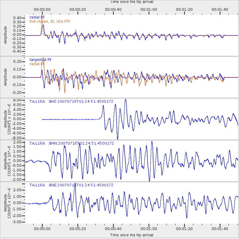
Signal To Noise
| Channel | StoN | STA | LTA |
| TA:L16A: :BHN:20070716T01:24:51.450017Z | 8.16005 | 4.3850076E-7 | 5.373751E-8 |
| TA:L16A: :BHE:20070716T01:24:51.450017Z | 7.217308 | 3.3306446E-7 | 4.614802E-8 |
| TA:L16A: :BHZ:20070716T01:24:51.450017Z | 71.55014 | 2.048165E-6 | 2.862559E-8 |
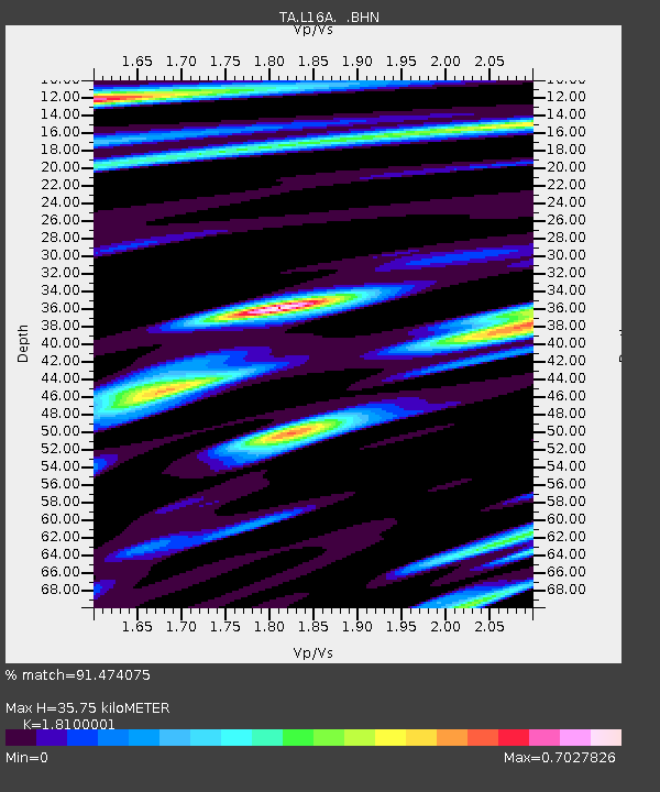
| Arrivals | |
| Ps | 4.8 SECOND |
| PpPs | 16 SECOND |
| PsPs/PpSs | 21 SECOND |

