
L16A Fish Haven, ID, USA - Earthquake Result Viewer
| ||||||||||||||||||
| ||||||||||||||||||
| ||||||||||||||||||
|
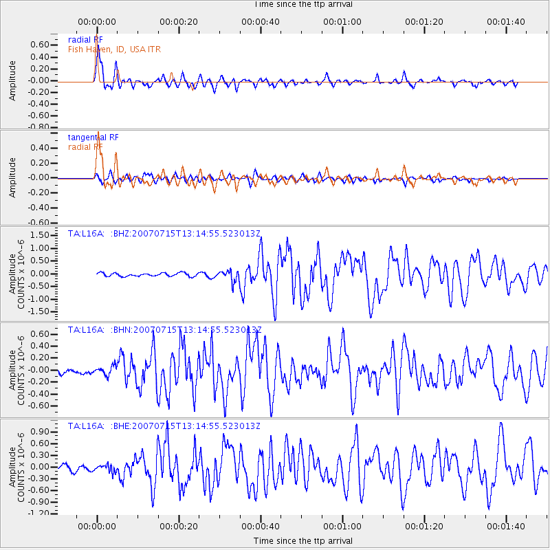
Signal To Noise
| Channel | StoN | STA | LTA |
| TA:L16A: :BHN:20070715T13:14:55.523013Z | 1.6488178 | 7.276229E-8 | 4.4129976E-8 |
| TA:L16A: :BHE:20070715T13:14:55.523013Z | 1.5237454 | 8.919585E-8 | 5.853724E-8 |
| TA:L16A: :BHZ:20070715T13:14:55.523013Z | 3.2985432 | 2.1195213E-7 | 6.4256284E-8 |
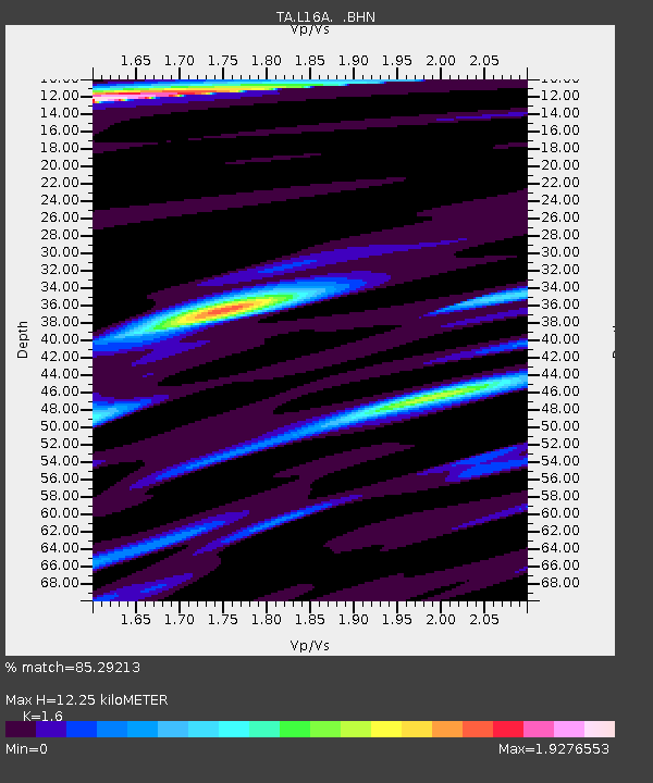
| Arrivals | |
| Ps | 1.3 SECOND |
| PpPs | 4.8 SECOND |
| PsPs/PpSs | 6.0 SECOND |

