You are here: Home > Network List > TA - USArray Transportable Network (new EarthScope stations) Stations List
> Station L16A Fish Haven, ID, USA > Earthquake Result Viewer
L16A Fish Haven, ID, USA - Earthquake Result Viewer

| Earthquake location: |
Tonga Islands |
| Earthquake latitude/longitude: |
-20.8/-173.3 |
| Earthquake time(UTC): |
2008/06/26 (178) 21:19:15 GMT |
| Earthquake Depth: |
38 km |
| Earthquake Magnitude: |
6.0 MB, 5.8 MS, 6.2 MW, 6.1 MW |
| Earthquake Catalog/Contributor: |
WHDF/NEIC |
|
| Network: |
TA USArray Transportable Network (new EarthScope stations) |
| Station: |
L16A Fish Haven, ID, USA |
| Lat/Lon: |
42.01 N/111.43 W |
| Elevation: |
2013 m |
|
| Distance: |
84.6 deg |
| Az: |
41.323 deg |
| Baz: |
236.016 deg |
| Ray Param: |
0.045277517 |
| Estimated Moho Depth: |
61.25 km |
| Estimated Crust Vp/Vs: |
1.65 |
| Assumed Crust Vp: |
6.207 km/s |
| Estimated Crust Vs: |
3.75 km/s |
| Estimated Crust Poisson's Ratio: |
0.21 |
|
| Radial Match: |
87.815025 % |
| Radial Bump: |
400 |
| Transverse Match: |
92.911644 % |
| Transverse Bump: |
400 |
| SOD ConfigId: |
2504 |
| Insert Time: |
2010-03-06 21:50:21.455 +0000 |
| GWidth: |
2.5 |
| Max Bumps: |
400 |
| Tol: |
0.001 |
|
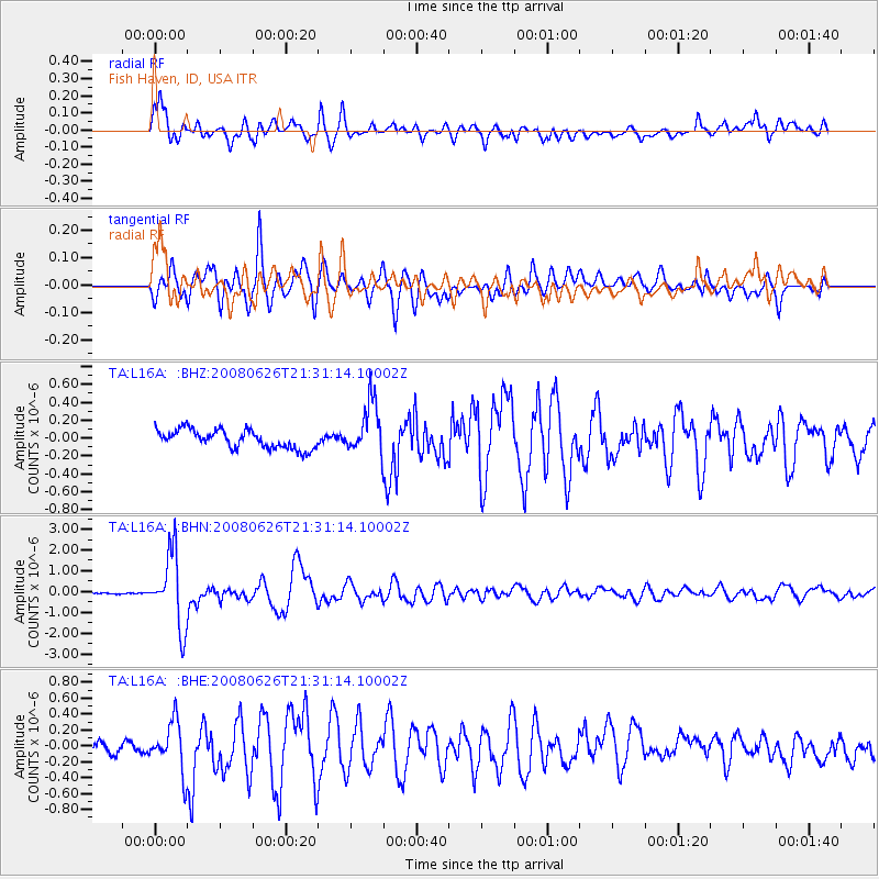
Signal To Noise
| Channel | StoN | STA | LTA |
| TA:L16A: :BHN:20080626T21:31:14.10002Z | 34.638134 | 1.7445445E-6 | 5.0364854E-8 |
| TA:L16A: :BHE:20080626T21:31:14.10002Z | 3.852149 | 3.0694022E-7 | 7.9680255E-8 |
| TA:L16A: :BHZ:20080626T21:31:14.10002Z | 2.8525846 | 2.9235446E-7 | 1.02487576E-7 |
| Arrivals |
| Ps | 6.6 SECOND |
| PpPs | 26 SECOND |
| PsPs/PpSs | 32 SECOND |


