You are here: Home > Network List > TA - USArray Transportable Network (new EarthScope stations) Stations List
> Station L16A Fish Haven, ID, USA > Earthquake Result Viewer
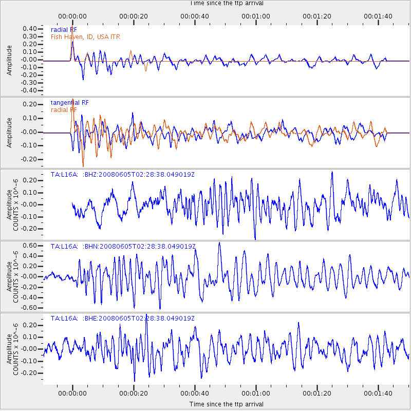
L16A Fish Haven, ID, USA - Earthquake Result Viewer
*The percent match for this event was below the threshold and hence no stack was calculated.
| Earthquake location: |
West Chile Rise |
| Earthquake latitude/longitude: |
-38.8/-91.6 |
| Earthquake time(UTC): |
2008/06/05 (157) 02:16:46 GMT |
| Earthquake Depth: |
10 km |
| Earthquake Magnitude: |
5.6 MS, 5.4 MB, 6.0 MW, 6.0 MW |
| Earthquake Catalog/Contributor: |
WHDF/NEIC |
|
| Network: |
TA USArray Transportable Network (new EarthScope stations) |
| Station: |
L16A Fish Haven, ID, USA |
| Lat/Lon: |
42.01 N/111.43 W |
| Elevation: |
2013 m |
|
| Distance: |
82.5 deg |
| Az: |
345.242 deg |
| Baz: |
164.518 deg |
| Ray Param: |
$rayparam |
*The percent match for this event was below the threshold and hence was not used in the summary stack. |
|
| Radial Match: |
78.64604 % |
| Radial Bump: |
400 |
| Transverse Match: |
59.661423 % |
| Transverse Bump: |
400 |
| SOD ConfigId: |
2504 |
| Insert Time: |
2010-03-06 21:50:41.549 +0000 |
| GWidth: |
2.5 |
| Max Bumps: |
400 |
| Tol: |
0.001 |
|
Signal To Noise
| Channel | StoN | STA | LTA |
| TA:L16A: :BHN:20080605T02:28:38.049019Z | 2.4819722 | 1.4240642E-7 | 5.7376315E-8 |
| TA:L16A: :BHE:20080605T02:28:38.049019Z | 1.1386926 | 4.0216367E-8 | 3.531802E-8 |
| TA:L16A: :BHZ:20080605T02:28:38.049019Z | 1.1368062 | 8.505932E-8 | 7.482306E-8 |
| Arrivals |
| Ps | |
| PpPs | |
| PsPs/PpSs | |


