You are here: Home > Network List > TA - USArray Transportable Network (new EarthScope stations) Stations List
> Station L16A Fish Haven, ID, USA > Earthquake Result Viewer
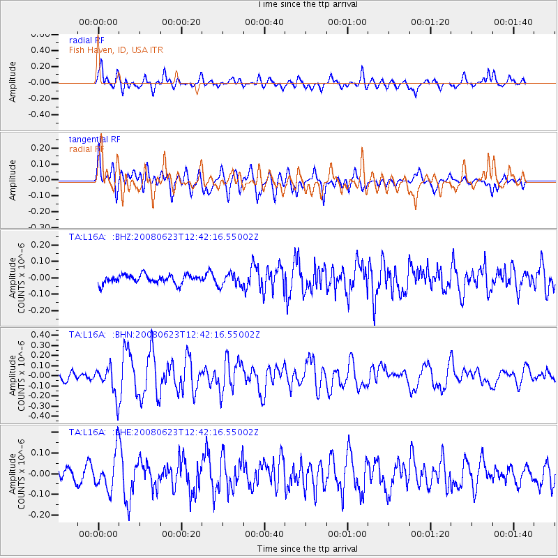
L16A Fish Haven, ID, USA - Earthquake Result Viewer
*The percent match for this event was below the threshold and hence no stack was calculated.
| Earthquake location: |
Kuril Islands |
| Earthquake latitude/longitude: |
46.5/153.3 |
| Earthquake time(UTC): |
2008/06/23 (175) 12:32:12 GMT |
| Earthquake Depth: |
10 km |
| Earthquake Magnitude: |
5.6 MB, 5.2 MS, 5.6 MW, 5.6 MW |
| Earthquake Catalog/Contributor: |
WHDF/NEIC |
|
| Network: |
TA USArray Transportable Network (new EarthScope stations) |
| Station: |
L16A Fish Haven, ID, USA |
| Lat/Lon: |
42.01 N/111.43 W |
| Elevation: |
2013 m |
|
| Distance: |
64.2 deg |
| Az: |
55.469 deg |
| Baz: |
310.19 deg |
| Ray Param: |
$rayparam |
*The percent match for this event was below the threshold and hence was not used in the summary stack. |
|
| Radial Match: |
65.585815 % |
| Radial Bump: |
400 |
| Transverse Match: |
63.002125 % |
| Transverse Bump: |
400 |
| SOD ConfigId: |
2504 |
| Insert Time: |
2010-03-06 21:51:33.778 +0000 |
| GWidth: |
2.5 |
| Max Bumps: |
400 |
| Tol: |
0.001 |
|
Signal To Noise
| Channel | StoN | STA | LTA |
| TA:L16A: :BHN:20080623T12:42:16.55002Z | 3.7044113 | 1.4750964E-7 | 3.9819994E-8 |
| TA:L16A: :BHE:20080623T12:42:16.55002Z | 1.5304517 | 9.1686566E-8 | 5.9908174E-8 |
| TA:L16A: :BHZ:20080623T12:42:16.55002Z | 1.4863819 | 3.9205965E-8 | 2.6376778E-8 |
| Arrivals |
| Ps | |
| PpPs | |
| PsPs/PpSs | |


