You are here: Home > Network List > TA - USArray Transportable Network (new EarthScope stations) Stations List
> Station L16A Fish Haven, ID, USA > Earthquake Result Viewer
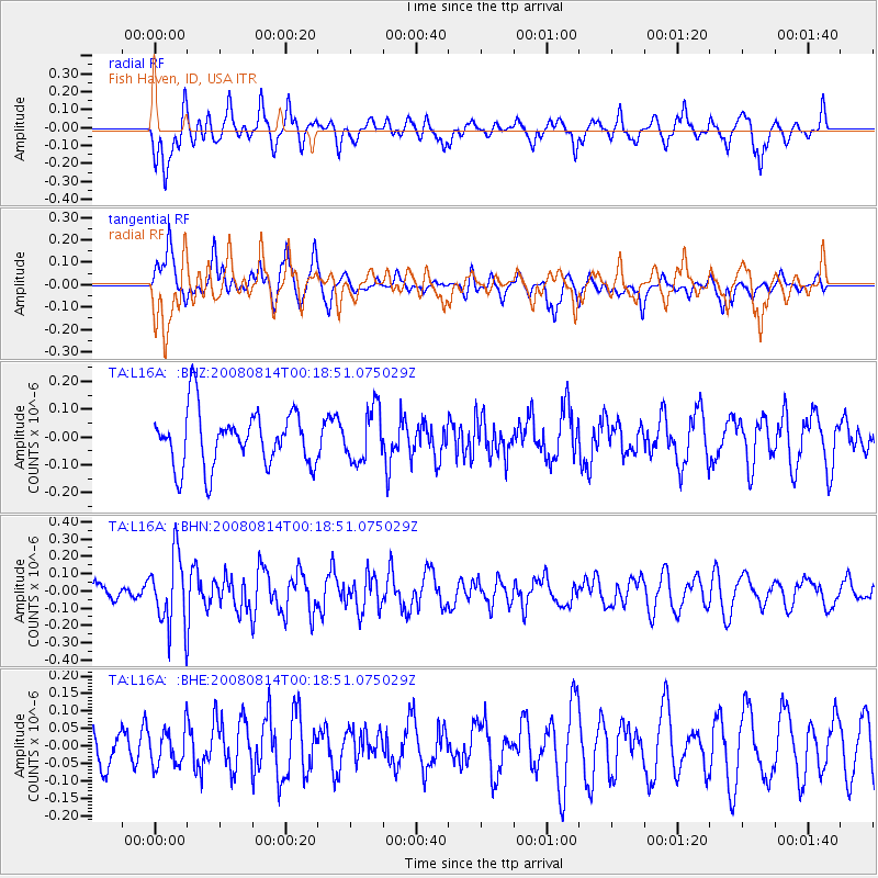
L16A Fish Haven, ID, USA - Earthquake Result Viewer
*The percent match for this event was below the threshold and hence no stack was calculated.
| Earthquake location: |
Mariana Islands |
| Earthquake latitude/longitude: |
16.4/146.9 |
| Earthquake time(UTC): |
2008/08/14 (227) 00:06:40 GMT |
| Earthquake Depth: |
53 km |
| Earthquake Magnitude: |
5.5 MB, 4.8 MS |
| Earthquake Catalog/Contributor: |
WHDF/NEIC |
|
| Network: |
TA USArray Transportable Network (new EarthScope stations) |
| Station: |
L16A Fish Haven, ID, USA |
| Lat/Lon: |
42.01 N/111.43 W |
| Elevation: |
2013 m |
|
| Distance: |
87.5 deg |
| Az: |
46.934 deg |
| Baz: |
289.81 deg |
| Ray Param: |
$rayparam |
*The percent match for this event was below the threshold and hence was not used in the summary stack. |
|
| Radial Match: |
62.652634 % |
| Radial Bump: |
400 |
| Transverse Match: |
68.26431 % |
| Transverse Bump: |
400 |
| SOD ConfigId: |
2504 |
| Insert Time: |
2010-03-06 21:51:42.438 +0000 |
| GWidth: |
2.5 |
| Max Bumps: |
400 |
| Tol: |
0.001 |
|
Signal To Noise
| Channel | StoN | STA | LTA |
| TA:L16A: :BHN:20080814T00:18:51.075029Z | 3.2483308 | 2.0491522E-7 | 6.308324E-8 |
| TA:L16A: :BHE:20080814T00:18:51.075029Z | 0.9742067 | 5.1863083E-8 | 5.323622E-8 |
| TA:L16A: :BHZ:20080814T00:18:51.075029Z | 0.96023923 | 9.4498596E-8 | 9.841151E-8 |
| Arrivals |
| Ps | |
| PpPs | |
| PsPs/PpSs | |


