You are here: Home > Network List > TA - USArray Transportable Network (new EarthScope stations) Stations List
> Station L16A Fish Haven, ID, USA > Earthquake Result Viewer
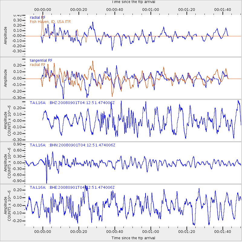
L16A Fish Haven, ID, USA - Earthquake Result Viewer
*The percent match for this event was below the threshold and hence no stack was calculated.
| Earthquake location: |
South Of Fiji Islands |
| Earthquake latitude/longitude: |
-25.4/-177.6 |
| Earthquake time(UTC): |
2008/09/01 (245) 04:00:39 GMT |
| Earthquake Depth: |
171 km |
| Earthquake Magnitude: |
5.7 MB, 6.0 MW, 6.0 MW |
| Earthquake Catalog/Contributor: |
WHDF/NEIC |
|
| Network: |
TA USArray Transportable Network (new EarthScope stations) |
| Station: |
L16A Fish Haven, ID, USA |
| Lat/Lon: |
42.01 N/111.43 W |
| Elevation: |
2013 m |
|
| Distance: |
90.7 deg |
| Az: |
42.993 deg |
| Baz: |
235.864 deg |
| Ray Param: |
$rayparam |
*The percent match for this event was below the threshold and hence was not used in the summary stack. |
|
| Radial Match: |
62.075893 % |
| Radial Bump: |
400 |
| Transverse Match: |
65.002205 % |
| Transverse Bump: |
400 |
| SOD ConfigId: |
2504 |
| Insert Time: |
2010-03-06 21:51:45.167 +0000 |
| GWidth: |
2.5 |
| Max Bumps: |
400 |
| Tol: |
0.001 |
|
Signal To Noise
| Channel | StoN | STA | LTA |
| TA:L16A: :BHN:20080901T04:12:51.474006Z | 3.1134632 | 2.7612538E-7 | 8.868754E-8 |
| TA:L16A: :BHE:20080901T04:12:51.474006Z | 1.2624439 | 1.0311391E-7 | 8.167802E-8 |
| TA:L16A: :BHZ:20080901T04:12:51.474006Z | 0.9370294 | 8.2859145E-8 | 8.842748E-8 |
| Arrivals |
| Ps | |
| PpPs | |
| PsPs/PpSs | |


