You are here: Home > Network List > TA - USArray Transportable Network (new EarthScope stations) Stations List
> Station L16A Fish Haven, ID, USA > Earthquake Result Viewer
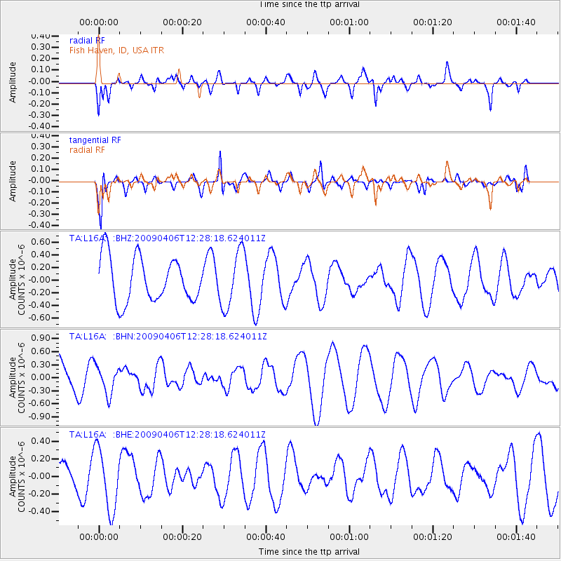
L16A Fish Haven, ID, USA - Earthquake Result Viewer
*The percent match for this event was below the threshold and hence no stack was calculated.
| Earthquake location: |
Tonga Islands Region |
| Earthquake latitude/longitude: |
-22.4/-174.9 |
| Earthquake time(UTC): |
2009/04/06 (096) 12:16:08 GMT |
| Earthquake Depth: |
35 km |
| Earthquake Magnitude: |
5.5 MS, 5.4 MB |
| Earthquake Catalog/Contributor: |
WHDF/NEIC |
|
| Network: |
TA USArray Transportable Network (new EarthScope stations) |
| Station: |
L16A Fish Haven, ID, USA |
| Lat/Lon: |
42.01 N/111.43 W |
| Elevation: |
2013 m |
|
| Distance: |
86.8 deg |
| Az: |
41.91 deg |
| Baz: |
236.059 deg |
| Ray Param: |
$rayparam |
*The percent match for this event was below the threshold and hence was not used in the summary stack. |
|
| Radial Match: |
69.80122 % |
| Radial Bump: |
400 |
| Transverse Match: |
80.72579 % |
| Transverse Bump: |
360 |
| SOD ConfigId: |
2760 |
| Insert Time: |
2010-03-06 21:51:53.281 +0000 |
| GWidth: |
2.5 |
| Max Bumps: |
400 |
| Tol: |
0.001 |
|
Signal To Noise
| Channel | StoN | STA | LTA |
| TA:L16A: :BHN:20090406T12:28:18.624011Z | 0.58307344 | 3.1005516E-7 | 5.3176E-7 |
| TA:L16A: :BHE:20090406T12:28:18.624011Z | 3.149833 | 3.4821522E-7 | 1.10550374E-7 |
| TA:L16A: :BHZ:20090406T12:28:18.624011Z | 1.2961153 | 4.5711815E-7 | 3.5268326E-7 |
| Arrivals |
| Ps | |
| PpPs | |
| PsPs/PpSs | |


